

The guide
How to use CartoVox, and everything it does.
Testers keep asking three questions: where do I find that, is it in there at all, and what does this setting actually do. This page answers all three. It opens with a searchable index of where every control lives, builds a world from nothing in about a minute, and then walks every workspace, menu and panel in the order the causal chain produces them — including the ones testers keep telling us they never knew were there.
Current as of the 0.9.0 beta, checked against a running copy. Version-by-version changes are on the release notes page. The same material ships inside the app under Help, offline.
Bold is a label exactly as the app writes it. World › Tools › Turn world means:
the World destination in the left rail, then the Tools menu in the dock along the bottom
of the map, then Turn world inside it. If you are ever lost, press ⌘K / Ctrl K
and type what you want — the command palette takes actions as well as names.
The answer to most questions
Where is it?
Type a word — rivers, print, Foundry, rename, backup — and this table narrows to the rows that mention it. Every path was checked against 0.9.
| What you want | Where it is |
|---|---|
| Start a world from a written description | Create › Brief — the World thesis box in fold 1 Your story |
| See what CartoVox produces before committing | Create or an empty Library › Build the example world (Eldrebrenn, a real project in your library) |
| Choose Sketch, Quick or Full | Create › Simulation detail, and as a default in Settings › Creation defaults › First build |
| Try a seed without building anything | Create › Preview this seed (approximate, nothing saved) |
| Search many seeds against the brief | Create › Find 6 strong matches, at Quick, Thorough or Deep search depth |
| Compare shortlisted worlds side by side | Create › Compare tab |
| All 306 simulation settings | Create › Advanced settings |
| Save this whole setup to reuse | Create › Advanced settings › Save as recipe; Export recipe writes it as a file |
| Import a heightmap or a painted map | Create › Import/Draw › Import my existing map |
| Draw coastlines by hand | Create › Import/Draw › Draw my own world |
| Decide what happens to rivers on an imported map | The map review › The rivers on this map: Keep the rivers I drew / Let CartoVox put the rivers / They are not rivers |
| Say how much of the planet your map covers | The map review › Your land on the planet, in % of the planet |
| Trim the painted ocean around your coast | The map review › Ocean kept around your land |
| Stop a finished world rebuilding your imported map again | Create › Foundation map › Remove map |
| Get back to the coastline check after closing it | Create › Advanced settings, then the Map review / World settings switch |
| Build a geological history first | Create › Deep Time tab |
| Every map of a finished world | World › Maps (the pill at the top left of the map) |
| Change the map's colours, projection or detail | World › View in the dock |
| Turn the world so a split continent is whole | World › Tools › Turn world, then drag sideways; 1:1 returns it |
| Grid, minimap, split view, time strip, HD region | World › View › Map aids |
| Rivers, watersheds, lakes and groundwater | World › Maps › Water & atmosphere — drainage area, watersheds, river hierarchy, river permanence, lake regimes, aquifers |
| Carve a river valley by hand | World › Tools › Sculpt › River valley — click each bend in turn; the whole course is one edit |
| Temperature, rainfall, seasons and Köppen | World › Maps › Climate & seasons |
| Winds, ocean currents, tides and ports | World › Maps › Water & atmosphere — four seasonal wind sheets, currents, coastal tides, maritime access |
| Realm borders, roads, farming and trade | World › Maps › Life & settlement — realm territories, landmarks & routes, border friction & trade dependence, domestication & farming, the agricultural calendar |
| Soils, bedrock, ore and oil | World › Maps › Terrain & geology — soils, soil properties, bedrock, geological survey, resource prospectivity |
| What a flood or a sea-level rise would cover | World › Maps › Water & atmosphere › Sea-level scenario explorer, and Floodplain & settlement exposure |
| How magic works in this world | Create › Brief › World constraints › Peoples & magic, and the impossible layer in Advanced settings |
| Ask a cell what it is and why | Click any cell on the map — the cell inspector opens |
| Why is it raining here | World › Tools › Explain climate, then click a cell |
| Measure a distance | World › Tools › Measure (key M) |
| Roads, ports, passes and places of power on one sheet | World › Tools › Landmarks (key L) |
| Zoom into one region and keep notes on it | World › Tools › Regional lens (key R) |
| Raise a mountain, cut a strait, move a city | World › Tools › Sculpt (key S) |
| Draw a circle and say what belongs in it | World › Tools › Sculpt › Describe a region |
| Rename one feature everywhere it appears | World › Tools › Sculpt › Select feature › Rename everywhere |
| A year of weather as a radar loop | World › Tools › Weather (key Y) |
| Test a changed tilt, season or ocean | World › Tools › Climate Lab (key K) |
| Plates, boundaries and what the Tectonic Director got | World › Tools › Tectonics (key T) |
| Could this world exist? | World › Tools › Advisor (key A) |
| The world as a landscape, a voxel model or a globe | World › Tools › 3D terrain |
| Compose a large layered drawing | World › Tools › Render (key N) |
| Tilt a finished sheet so ridges stand up | World › Tools › Render › Saved renders › Oblique view on a finished render |
| Put labels on a render | Render Studio › the lettering chooser, under the layer list |
| The illustrated plates | World › Atlas tab |
| Draw plates you deferred during the build | World › Atlas › Render remaining plates |
| Print the atlas as a book | World › Export › Bound atlas, print-ready (PDF) |
| Plan a journey between two places | World › Travel tab |
| A player-safe view of the world | World › Campaign tab › Present player view |
| A village, town or city plan | World › Scenes › Create or import settlement (Settlement Studio) |
| A battlemap for Foundry, Roll20 or Fantasy Grounds | Settlement Studio › the export row: Universal VTT (.dd2vtt) or Foundry scene |
| An encounter map with no world behind it | Library › Scenes and encounter maps |
| Give scene walls a height so they cast shadows | Scene settings › Height and shadow |
| Rename realms, cultures, faiths, settlements in one place | Write › Codex › Rename everything |
| Write the prose the generator left blank | Write › Codex › Describe everything |
| Everything the world measured about a named thing | Write › Codex › Gazetteer |
| Invent a language and hear its names | Create › Brief › Peoples & languages › Language families, and Write › Codex › Naming studio |
| Authored history, eras and events you can play | Write › Chronicle tab |
| Write the book | Write › Manuscript tab |
| Import a manuscript you already have | Write › Manuscript › Import book (or Import chapter) |
| Readability and passive voice per chapter | Write › Manuscript › Book › Insights |
| Export the book to Word, Markdown, Scrivener, EPUB | Write › Manuscript › Book › Export book… |
| An Obsidian vault of the whole world | Write › Codex › Illustrated Obsidian vault (.zip) |
| Numeric rasters for QGIS | World › Export › Scientific rasters + metadata (.zip) |
| Coastlines as real polygons | World › Export › Coastlines + GIS features (GeoJSON) |
| A 3D print or a mesh for Blender | World › Export › Terrain surface (STL) or (OBJ) |
| Back the whole project up, or move it to another machine | World › Export › Complete project backup (.cartovox), restored with Library › Import project backup |
| Build the same world again at a finer grid | World › World drawer › Rebuild at full simulation resolution |
| The same inputs under a different seed | World › World drawer › How this world was built › Reseed this world |
| Load a finished world's settings back into Create | Same fold › Build another like this or Replicate this world |
| What the simulation thinks is wrong with this world | World › World drawer › Simulation health |
| Go back to an earlier version of the world | World › World drawer › Revision history; Create named checkpoint marks one |
| A deleted world | Library › Trash — 30 days for a saved world, 7 for a cancelled build |
| Theme, text size, units, density | Settings › Appearance and Accessibility (⌘, / Ctrl ,) |
| Turn the helper sentences under controls on or off | Settings › Appearance › Explanations |
| Hide the specialist panels (or get them back) | Settings › Workspace & layout › How much to show at once |
| Where worlds are stored, and how to move them | Settings › Data & privacy › Change save folder |
| Reclaim disk without losing anything | Settings › Data & privacy › Storage and display cache |
| Which version am I running | Settings › Updates & support › About; Copy app info for a bug report |
| Release notes, offline | Settings › Release notes |
| Report a bug | Settings › Updates & support › Report a bug on Discord, or World › Tools › Report for a specific map |
| The manual inside the app | Help, bottom of the left rail |
| The welcome tour again | ⌘K / Ctrl K › type Take the tool tour |
| Hide the interface and just look at the map | Focus map in the dock (key F), or fullscreen beside it |
| Undo a terrain edit before it is applied | The Sculpt panel's own Undo / Redo, and Discard edits |
| Print, paper size, dots per inch | World › Export › Bound atlas, print-ready (PDF) — see everything that exports |
| Keyboard keys | Press ? on the map, or ⌘/ in the manuscript |
Nothing matched? The sections below cover surfaces this index does not name, and the beta Discord is the place to ask.
New in 0.9
The sheet on the desk.
0.9 is everything implemented after 0.8.3, and it outgrew the number it was planned under. The whole interface has been restated, the map became something you draw on and describe rather than only look at, and every name and every description in a world can now be written on one sheet. The short list, before the workspace-by-workspace walk below; the full account is in the release notes.
- The interface is a survey sheet — a thumb-index rail, a title block, each workspace a sheet on a desk, floating map cards as dark instruments with a brass top edge, chips as stamps, and every measured number set as a tabular figure. Archivo and DM Mono ship under the OFL beside Newsreader; 205 corner radii were flattened to one geometry, and the light theme was rebuilt as a daylight desk rather than an inverted dark one.
- The World workspace is map-first — the rendered map is the page, a World / Maps pill sits at the top left above the drawer it opens, and everything that acts on the map lives in the dock along the bottom. The map, below.
- A Sketch tier — a whole world at quarter resolution in about half a minute, promotable to Quick or Full later as its own project. Preflight and finish.
- Draw a shape, and say what belongs there — Describe a region places what it can (a named region, a codex page, a gazetteer entry, carrying your words as its lore), moves the ground where the words describe ground, and reports the words it could not place. Sculpt.
- Turn world — a map tool that moves the meridian the sheet is cut at, so a continent split across the edges can be brought to the middle. The dock.
- Rename everything, and describe everything — every named thing on one editable sheet, and the prose the generator deliberately leaves blank in one place beside it. Codex.
- Your map's own rivers — a river drawn on an imported map is read as a river rather than a sea inlet, and you choose whether the world keeps your lines, solves its own, or treats the blue as water. Import a map.
- Deciding how much of a planet your map is — say what share of the planet your continent covers and CartoVox sizes the sheet to match, with a control that trims the ocean you painted around your coast.
- The oblique camera — tilt a finished render until the terrain has a far side, with the scale bar and compass left flat on the paper and the picture saying that its vertical scale is invented. Render Studio.
- The atlas, bound as a book you can print — title page, contents, a page per plate at a real paper size, a colophon carrying the seed, and every plate embedded at its own resolution. Exports.
- Settlements you can play on — a town leaves as a Universal VTT (
.dd2vtt) or a Foundry scene, with walls, doors and line of sight decided rather than guessed. Settlement Studio. - Encounter maps with height — give a wall or a tower a height in your scene's own units and it casts a shadow from one sun, with nothing tilted and every footprint still on its square. Scenes.
- Watch the world being made — a build shows the land and relief about seven seconds in, then the climate and biomes, drawn from fields the simulation had already computed. A watched build and an unwatched one produce identical saved fields.
- An illustrated first-run tour, and an example world — six panels of drawings instead of 1,587 words, and one click builds Eldrebrenn: a complete project in your own library, measured at 83.9 seconds and 179 MB. Library.
- Exports that carry what they claimed to — real GeoJSON coastlines with lakes as holes (agreeing with the saved land mask to 99.94% of cells), and OBJ/STL meshes at the whole grid instead of 3.2% of it.
- No network request of its own — the daily update check is gone, along with the installer download it fed and the certificate bundle it needed. New builds are announced on the Discord server, and App settings → Updates & support says so.
Start here
First launch
Two things stand between installing CartoVox and a world, and both are deliberate.
- The licence. The first window is the End User License Agreement. Tick I have read and accept
and Unlock becomes available. The same text stays readable at
Settings › Updates & support › Licence. - The access key. Paste the key sent to you and choose Unlock CartoVox. Verification happens entirely on your computer: no account, no activation server, no hardware fingerprint. The key is personal to you and is stored in CartoVox's own application-data folder.
- Then a six-panel tour — what the app simulates, how you describe a world, trying seeds, the three build sizes, drawing the atlas, and a finished world you can open on the spot. It appears once per version and can be closed at any panel. The manual did not go anywhere: it is under Help at the foot of the left rail.
- Unsigned installers. macOS Gatekeeper and Windows SmartScreen will warn you, because the builds are not code-signed yet. Each release publishes checksums; install only the file shared in the beta Discord.
- It makes no network request of its own. No update check, no telemetry, no account. The only address it opens is the loopback dashboard it started itself.
Build the example world on the Create screen (and on an empty Library) builds Eldrebrenn from a fixed recipe: a complete project with data maps, illustrated plates, dossier, codex and gazetteer. A measured 83.9 seconds and 179 MB on a fast Apple Silicon Mac. It is a real project in your own library — open it, sculpt it, rename its realms, or throw it away. Nothing is built unless you press the button.
Orientation
How the app is laid out
One window, five destinations, one record. Learn this and nothing is more than two clicks away.
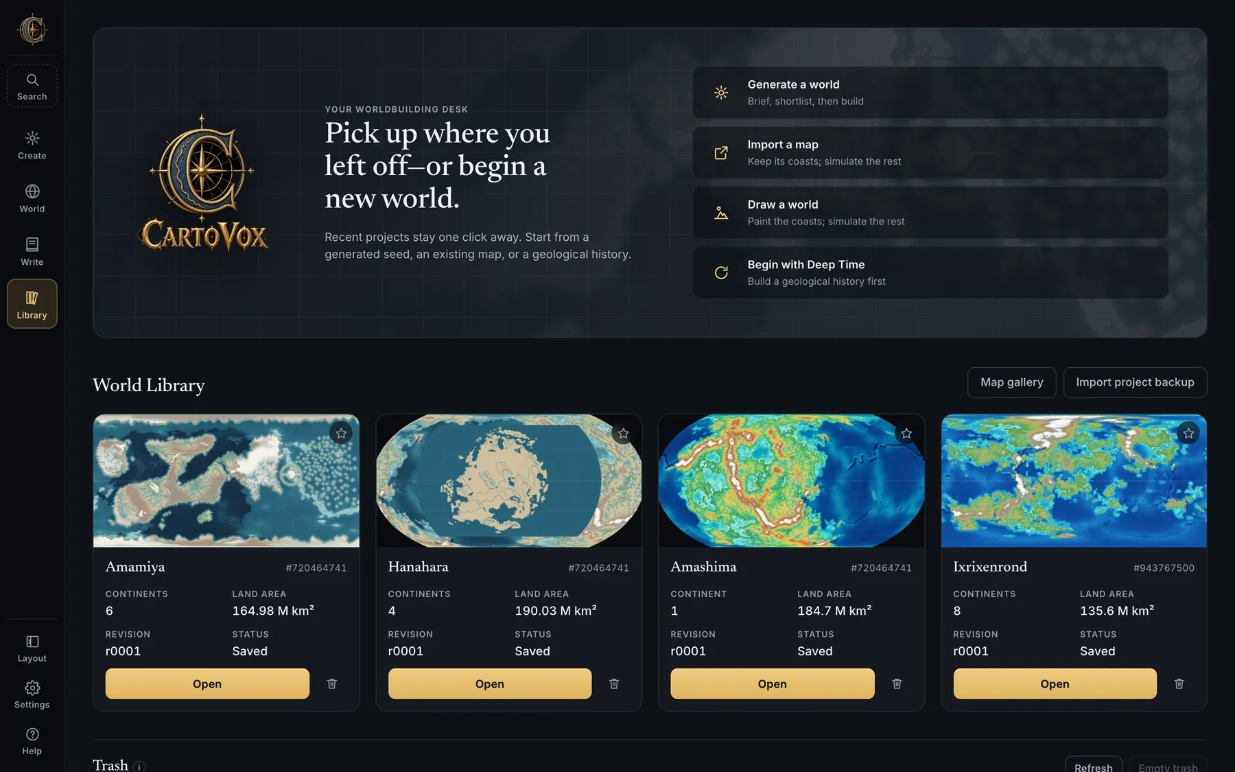
The left rail
| Rail button | What lives there |
|---|---|
| Search | A command palette and a library-wide index in one (⌘K / Ctrl K). Type a world, realm, settlement, natural region, lore entry, Chronicle era or campaign and jump to it — or type an action, such as “Define a tongue” or “Open Advanced world settings”, and it opens the panel. |
| Create | Everything before a world exists: the brief, seed search, Advanced settings, import, drawing, Deep Time. Tabs: Brief, Deep Time, Compare. |
| World | The finished world. Tabs: Map, Atlas, Travel, Campaign, Scenes. |
| Write | Names, lore and the book. Tabs: Chronicle, Codex, Manuscript. |
| Library | Saved worlds, the four ways in, the map gallery, project import, and the trash. |
| Layout | Hide regions of the interface — the top bar, rails, panels. Choices persist and a fixed handle always leads back. |
| Settings | This installation only: appearance, accessibility, layout, creation defaults, data, support, release notes. |
| Help | The five-minute manual, known limits, the licence, third-party notices, and a task-based tour of the tools. |
Each workspace is a sheet on a desk
- Create is one strip of actions above a folding brief, with the doors into import and drawing in the stage itself.
- World is map-first: the rendered map is the page. A two-segment pill at the top left — World, Maps — opens the drawer beneath it. Everything that acts on the map is in the dock along the bottom: View, Export, Tools, the zoom controls, Focus map and fullscreen. The planet floats top right as its own card and can be put away; the colour key and the coordinate line sit bottom left.
- Write is one strip above the page, with More and Book menus and a single panel switch.
- Workspaces resume. World and Write reopen on the tab you last used.
Settings › Workspace &
          layout
can turn that memory off without erasing it. - A long build keeps running while you work elsewhere. The generation dock shows the phase, the plate and an ETA, and survives navigating away or reloading.
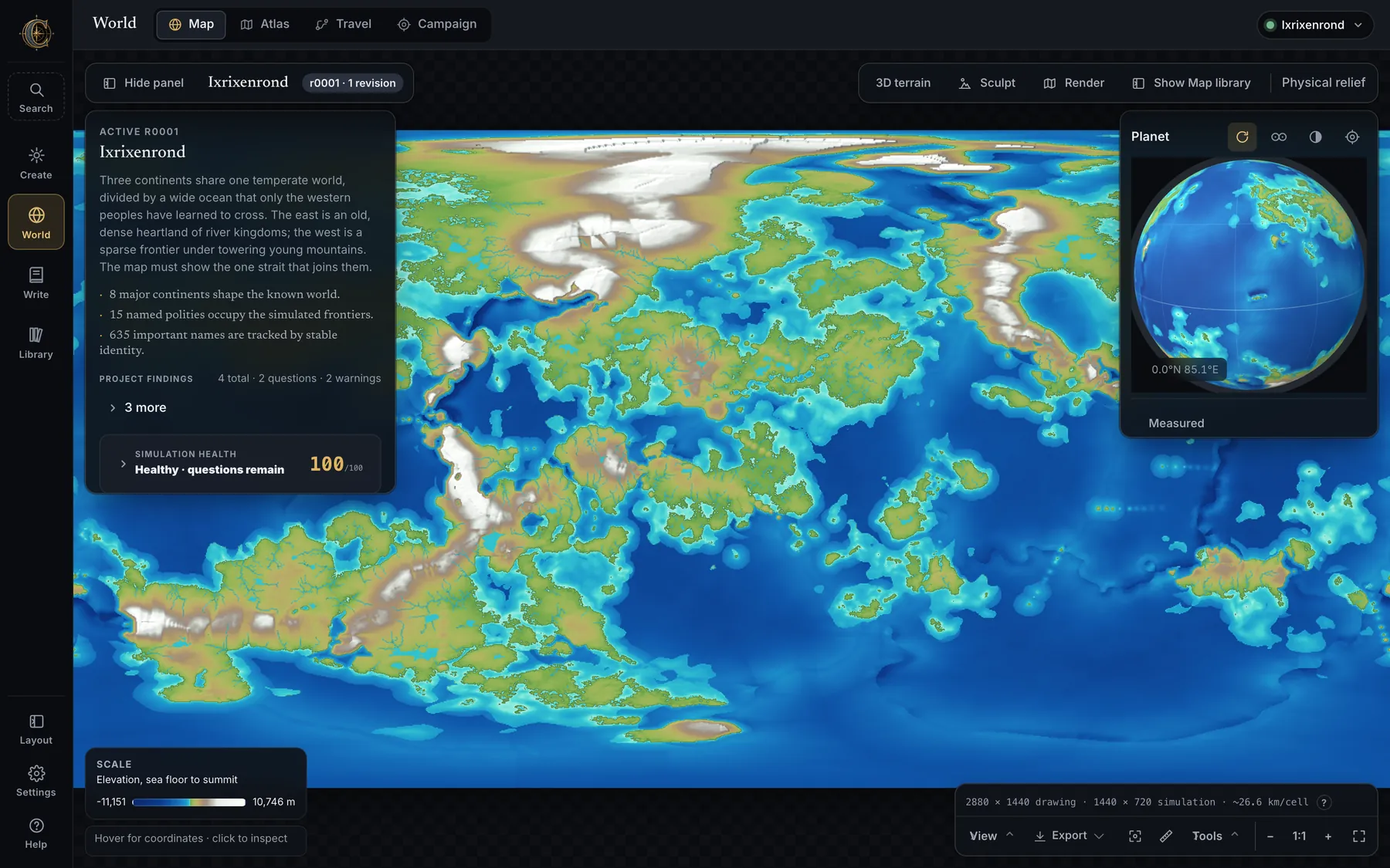
1440 × 720 drawing · 1440 × 720 simulation · ~26.6 km/cell — drawing density and simulated detail are never confused with each other.- ⌘, (or Ctrl,) opens App settings from anywhere.
- The rail's Search is also where the command palette lives — it takes verbs as well as names.
- Hide the top bar and the Layout handle still offers a way back to Settings.
Tutorial
Your first world, start to finish
About a minute of computer time, on a machine that can run the app comfortably. Do this once and the rest of this page will make sense.
- Open Create. If the four doors are showing, choose Generate a new world, then a purpose (campaigning, climate study, an illustrated atlas, artwork, or writing). The purpose tunes which options are visible; it is not a preset. Skip — I know what I want goes straight to the sheet.
- Write two sentences in World thesis: what the world is, what is scarce or contested, and what the map must show. As you type, CartoVox reads it and offers each cue it recognised with its own Apply button — it never edits your brief for you. Use an example thesis writes a worked one for the silhouette you picked.
- Pick a shape. Fold 2 Planet & geography holds Planet type (Earth-like, Ice age, Lush and warm, Tilted world, The long day, The long winter, Great moon, Young and violent, Greenhouse ocean, Thin air, Dim star) and Geography (Balanced Earth-like, Pangaea, Shattered Archipelago, Inland Sea, Twin Hemispheres, Rifted Continent, Drowned Interior, Fjordland, Equatorial Belt). They are separate choices, so changing the kind of planet does not have to masquerade as changing its landmasses.
- Set Simulation detail to Sketch. A measured reference build finished in 30.5 seconds with an illustrated atlas on a fast Apple Silicon Mac. A Sketch is a real world, not a preview — every stage runs and the saved archive holds the same members.
- Press Preview this seed to see one candidate drawn in seconds, or Find 6 strong matches to score a batch of seeds against the brief. Keep the one you like.
- Read the two grey rows above the sheet before you commit: OUTPUT says what you will get, COST says how long and how much disk. The estimate learns from completed builds of the same shape on your own machine.
- Press the gold button. It names what you are committing to — Create Sketch world, Create Quick world, Create full-resolution world, or Generate publication atlas. The build shows you the world as it makes it: land and relief appear about seven seconds into a Quick build, and the map returns wearing its climate and biomes once rainfall and temperature have decided what grows where.
- Open it. The world lands in your Library and opens in World. Click a cell to ask it what it is. Open Maps to see the other fifty-odd views of the same geography. Open Atlas for the illustrated plates.
Nothing about starting small is a dead end: a coarser world can be rebuilt on a finer grid, as a separate project that leaves the one you liked exactly as it was. How, and what moves when it happens.
Create
Four ways in, then a purpose.
Create opens with a choice, not a form: Generate a new world, Import my existing map, Draw my own world or Build through deep time. A second choice — campaigning, climate study, an illustrated atlas, a base for external artwork, or writing and worldbuilding — tunes visible options rather than hiding a preset system. Skip — I know what I want goes straight to the sheet.
- One strip above a folding brief. Since 0.9 the doors are in the stage rather than in a panel of their own, and the strip carries the route (Generate / Import/Draw, with Why this route and Change), the setup counter, Advanced settings, Preview this seed and the gold button. Below it sit the world shape, the seed, Reset all, and two grey rows: OUTPUT (what you will get) and COST (how long, how much disk).
- Foundation map — a row that names the imported or drawn map your next world will be built on, beside the button that uses it, with Remove map in the same row. An attached map replaces the geography of everything generated from that sheet until you take it off.
- Setup guide — an optional six-step guide (choose how to begin, write the brief, name the peoples and their tongues, preview a seed, find strong matches, review the cost) that shows which simulation systems each setting affects. The strip counts it as Setup · n/6; Expert view puts it away.
- Reset all restores the entire creation surface, not a hidden subset. Draft recovery brings back unsaved Advanced-settings work after an accidental Back.
- Create Sketch world vs Create Quick world vs Create full-resolution world vs Generate publication atlas — the gold button says which cost you are committing to.
The World Brief
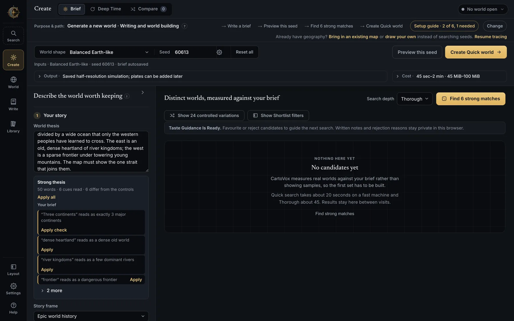
Five numbered folds, each summarising itself in its own header so a closed brief still says what it holds.
| Fold | What it holds |
|---|---|
| 1 Your story | The World thesis and its live reading, and Story frame (epic world history, and other frames that shape the emphasis of generated lore). |
| 2 Planet & geography | Planet type, Geography, and Star, orbit & moon — day length, year length, stellar flux, lunar tide. Each fold states what it does not model. |
| 3 Peoples & languages | Nations, cultures and tongues — name realms and capitals before generation, request homeland traits, biomes, resources and trade goods, and drop a homeland pin with a visible search area. Language families blends real-language-inspired flavours by weight and previews a dozen names with glosses before the world exists. |
| 4 World constraints | Land & sea, Climate & water, Peoples & magic — each a row of plain-language choices that summarise themselves in the fold's own header. |
| 5 Tectonic intent | The Tectonic Director: craton nuclei, plate seeds, requested convergent/divergent/transform margins, drift bearings and speeds, and mantle hotspots. Partial intent is fine. The finished world reports which intentions were satisfied, compromised or impossible. |
- World thesis — a paragraph about what the world is, what is scarce or contested, and what the map must show. The reading finds landforms, climates and ways of life it names and checks them against the structured brief, one Apply per cue and Apply all for the lot. Which words does it know? prints its own vocabulary, and a worked example thesis exists for every silhouette.
- Must have / Prefer / Avoid — hard constraints and soft ones. A standalone continent count counts connected landmasses of at least 2 million km²; matches come before alternatives, misses state the actual count, and the saved world re-checks the final simulation.
- Story frame — epic world history, and other frames that shape the generated lore's emphasis.
- Geography — nine continental starting points: Balanced Earth-like, Pangaea / Supercontinent, Shattered Archipelago, Inland Sea / Mediterranean, Twin Hemispheres, Rifted Continent / Great Rift, Drowned Interior / Flooded Lowlands, Fjordland / Long Coasts, Equatorial Belt. Your saved recipes appear in the same list.
- Planet type is chosen separately from that geography, so changing the kind of planet does not have to masquerade as changing its landmasses: Earth-like, Ice age, Lush and warm, Tilted world, The long day, The long winter, Great moon, Young and violent, Greenhouse ocean, Thin air & cold desert, Dim star. Nineteen presets in all, since Balanced Earth-like is both.
- Star, orbit & moon folds into the same section, summarising itself as the day length, the year, the stellar flux and the lunar tide it currently describes.
- “Lush” means few deserts — it weakens subtropical subsidence and strengthens inland moisture recycling instead of merely raising rainfall. “Few deserts” in a thesis and “Avoid: deserts” pull the same lever.
Nations, cultures and tongues — and the Tectonic Director
Two panels most people never open, because they sit below the brief. This is where an author's empires go.
- Nation Brief — name realms and capitals before generation; request homeland traits, biome preferences, resources, trade goods and cultures; drop a homeland pin on a map with a visible search area and plain-language size choices (exact latitude, longitude and distance stay optional). Accepted homelands enter the civilisation pipeline as founding hearths; locked names flow through the naming registry so maps, dossiers and lore agree.
- Tongues — define a language by blending ten real-language-inspired flavours (French, Russian, Latin, Old English, Spanish, Cherokee, Greek, Old Norse, Arabic, Japanese) by weight, describe it in a sentence and watch the chips follow, add words you like, and preview a dozen names with glosses and pronunciation before the world exists. A tongue travels with the brief and can be preferred or locked to a realm.
- Tectonic Director — an interactive coordinate map for craton nuclei, plate seeds, requested convergent, divergent and transform margins, drift bearings and speeds, locks and mantle hotspots. Partial intent is fine; CartoVox fills the rest. Preflight flags contradictory requests before a long build, and the finished world reports which intentions were satisfied, compromised or impossible.
- Domestication — whether wild-crop packages may relocate civilisation hearths is an explicit choice on the route, not a hidden setting.
Seed search
- Preview this seed draws one candidate; Find 6 strong matches scores reproducible seeds against every measurable requirement. Search depth sets how many it tries — Quick 18 seeds, Thorough 36 (the default), Deep 72 — and nothing is saved by a search.
- Candidate cards — Preview, Compare and More in one row; the consequential creation button on its own row. Cards distinguish measured checks from constraints that still need author review, and previews are labelled approximate because the production grid can change small islands.
- Show 24 controlled variations — structurally distinct alternatives of the same brief. Shortlist filters narrow the set.
- Favourite, reject, annotate — favourites and rejections become an adjustable taste signal for later searches; notes and rejection reasons never leave the browser. Hard constraints stay authoritative.
- Compare lays candidates side by side with a coast-complexity scale and the same measured/review badges.
- Results stay between visits; a run's settings are preserved even when it fails or is cancelled, and the completion panel offers Adjust these settings.
Advanced settings, presets and recipes
The sheet has 306 inputs in twenty groups, in the order the simulation uses them, each with a note and its allowed range. Nothing is hidden in a module.
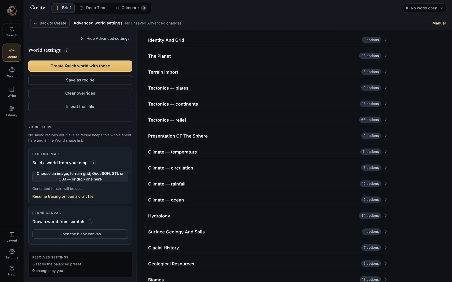
- Planet — radius, gravity, rotation and day length, orbital year, axial tilt, eccentricity and periapsis phase, star luminosity and distance, land share, tides, atmospheric pressure, an explicit greenhouse forcing, ocean salinity, and one dominant moon's mass, distance, period and inclination. Authored year lengths are allowed; a Kepler mismatch is shown, not corrected.
- Ice is emergent by default; ask for a global cover from 0 to 0.98 and the dossier records the temperature adjustment it took.
- Seasons — climate at 4, 8 or 12 samples per orbital year, weighted by orbital residence time so eccentric worlds are not over-counted at perihelion.
- Tectonics, relief, hydrology, lakes, glaciation, erosion, shelves, coasts, hearths — every lever has a plain-language row: more islands, higher mountains, more perennial rivers, more closed saline lakes, an ice age, a greenhouse world. Settings are bounded only where a value would break the simulation; a 62° tilt with tropical poles is still reachable.
- Recipes — Save as recipe keeps the preset plus only the settings you changed (up to 24, 64 KB per import). Export recipe / Import from file moves one between machines; imports preview and ask before applying. Last generated is written automatically at the start of every run in a reserved slot, so the settings behind a disappointing world are never lost.
- Terrain image interpretation, magic source and cost, naming-family rules, apostrophe policy, atlas label density, lake detail and map palette are dropdowns with friendly labels over stable internal values.
- Changing the World shape asks “Discard 3 changed settings?” first; Clear overrides says how many it will lose. The whole sheet survives a reload, and the Advanced settings button on Create carries the override count.
Simulation detail, preflight, finish, plates and lettering
| Tier | Grid | What it is for |
|---|---|---|
| Sketch | Quarter resolution (360 × 180) | A whole world in about half a minute. Blocky coastlines, every stage run, the same archive members. A fast look at a seed you intend to keep. |
| Quick | Half resolution | Coarser coastlines, much faster. The usual working tier. |
| Full | The production grid | What every published map is drawn from. |
- Every tier runs the same simulation, and saves the same archive members, so the codex, dossier, gazetteer, data maps and exports all work on a Sketch. The difference is how many cells the simulation was evaluated on, and nothing else. The same three-way choice is in Create and in Settings → Creation defaults → First build, and the two stay in step.
- A Sketch can be promoted one rung at a time. The saved-world rebuild takes a target tier, so a Sketch can become Quick without paying for Full. As before, the rebuild starts a separate project and leaves the world you chose exactly as it was. An unrecognised tier is refused with a message naming the three that exist, rather than quietly downgraded.
- Preflight reports the expected output range and free disk for the chosen grid, finish and sheet set, keeps a 1 GiB reserve, and learns from completed builds of the same shape on this machine. Reference bands: 45–100 MiB Quick, 180–360 MiB Full without plates, 337–883 MiB with every publication plate.
- A build shows you the world it is making. Land and relief appear about seven seconds into a Quick build, and the map returns wearing its climate and biomes once rainfall and temperature have decided what grows where. The pictures come from fields the simulation had already computed, add a fraction of a second, and change nothing: a watched build and an unwatched one produce identical saved fields. A frame that cannot be drawn is skipped in silence.
- Atlas finish — Draft or Publication. Sheet groups — world, continent and regional sheets, selectable. Village label density for the minor names.
- Atlas lettering — Labeled only, No labels, or Both from the same illustrated base; the choice applies to world, continent and regional sheets, and the missing variant can be added later without re-simulating.
- Stop after this plate finishes the active image cleanly and stores the rest; Render remaining plates in World → Atlas draws them later from saved data.
- Best-quality drawings rebuilds a Quick world's eligible maps at 4× drawing density from the exact saved simulation; Rebuild at full simulation resolution makes a separate project from the same seed and recipe.
- Progress weights phases by measured wall time — naming gets its real share — and recalibrates the ETA from completed plate timings. Interrupted runs are detected and can be resumed from their stage checkpoint or removed.
Import a map
- Formats — PNG, JPEG, TIFF, numeric height grids, GeoJSON land outlines, shapefiles, GeoTIFFs, Azgaar exports, and OBJ or STL terrain surfaces (X east, Y north, Z metres). A GeoTIFF or an Azgaar export is read as what it is rather than as an anonymous image, and land can be raised from a shapefile. Limits scale with free disk and are reported before the import.
- The coastline reader distinguishes pale oceans, dark silhouettes with lakes, sepia maps, painted biome maps and true heightfields; painted-map imports learn blue water shades including bathymetric bands, keep continents that touch the edge, and detect a rectangular map inside a dark interface border (Use detected map area). Map lettering that reads as land is cleaned out; round islets are left alone.
- It learns the sea from the sea, not from the frame. On a whole-world sheet the colours crowding the border are the ice caps, so a planet a quarter covered in continents used to come back as 80% land; the water is now learned from the blue that reaches an edge of the sheet, wherever it sits. A tinted country drawn out to the coast stays on the map, an island painted close to the colour of the sea keeps its coast from about 12° of hue away instead of 40°, and a landlocked sheet — a kingdom with a lake, a river basin — is no longer read inside out. The panel says which way it read your sheet, and Water tolerance moves the line between shallows and sea.
- An imported map's plates are fitted to the coastline it brought. Plate boundaries used to cut across the land you supplied; measured against a real import, boundary-on-land fell from 40% to 4.1%. Imported terrain also stops reading as ice: heights were being scaled so that far too much of the world sat above 2,000 m, and a round-trip of a saved world's own elevation now lands where it started.
- Zoom & inspect opens the upload and the interpreted coastline in a full-window viewer. Paint land / Paint water, Protect region (frozen in gold, with its one-pixel rim), Undo correction and Reset corrections correct the reading and survive another detection pass.
- Trace the coastline yourself — click corners or sketch freehand over the faded upload; Magnetic tracing follows nearby image edges between anchors; Auto trace offers Fine, Balanced or Smooth outlines and a minimum island area, and reports what it removed. Tracing saves recoverable drafts automatically; Resume tracing reopens them after a restart, and Save draft file writes a portable
.cartovox-trace.jsonwith the reference image embedded. - The questions the map leaves open — where borrowed relief should gather, how high the peaks reach, whether the land is young or worn, how deep the seas are, how wet and warm the world is, how closely climate should follow painted colours. Every answer is an ordinary Advanced setting; an unanswered question keeps the preset.
- The rivers on this map — narrow blue inside your coastline is read as a river and drawn back over your map in blue with a count, because a lake or a sea is wide and a river is narrow wherever you cut across it. Keep the rivers I drew cuts each one into the surface as a strictly descending channel, so the ground the hydrology solves has one lowest path and it is your line; on a hand-drawn test map 9 of 9 rivers were followed, 89% of their drawn cells, with a mean cut of 96 m. Let CartoVox put the rivers takes your lines out of the coastline just the same, so your continent is whole, then leaves where the water runs to the terrain, rainfall and slope — and the same map came out with its own rivers falling on 8 of your 9 lines anyway. They are not rivers keeps the blue as water, right for straits and fjords, and is the only one of the three that leaves an inlet cut into your land. A river may cut a valley through a mountain but may not delete it: both the channel and the ground beside it are bounded at 400 m.
- Your land on the planet — type the share of the planet your land should cover and CartoVox resizes the sheet to reach it, measured on the sphere so ground near the poles does not count for more than it is. The panel names the full range your map can reach, says so plainly when you ask for one it cannot, and stops where the poles do rather than scaling a taller-than-2:1 sheet quietly back off.
- Ocean kept around your land — an imported sheet is usually a continent adrift in its author's painted sea, and the width control used to resize both. Trim from the whole sheet down to a crop tight at the coastline: a test map that is 85% water went from 11.5% of the planet to 34.7% without a pixel of the coast moving. The coastline itself is never touched; CartoVox fills what it removes.
- Map review or World settings — the two share a column, with a switch above them. Advanced settings opens the settings sheet; a map arriving opens its review, because a coastline wants checking first. Either is one click from the other, for an uploaded map and a drawn one alike.
- What a map does not say is simulated: climate, rivers, biomes, settlements, names and lore. Provenance records that the coastline was imported or traced, over which file, and which of the three river answers the world was built with.
Draw your world
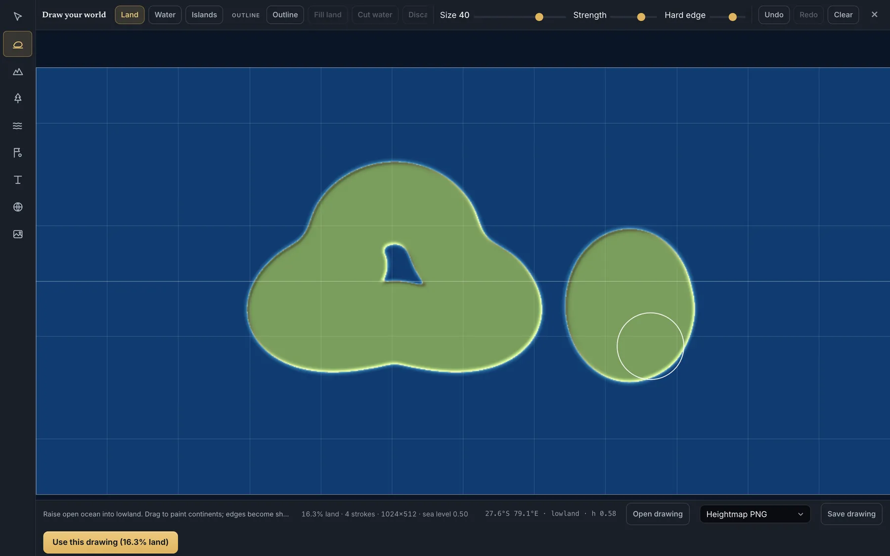
- Brushes — Land, Water, Islands, Outline, Raise, Lower, Smooth, Flatten, with size, strength and hard-edge controls, undo and redo, and a seeded starting shape to sculpt. The ocean wraps east–west, because it is a planet.
- Rivers are carved as descending valleys so the hydrology solver has a lowest path; the finished world reports how much of each drawn river it actually followed. Beside the river tool is the same choice the importer offers — keep the ones I draw or let CartoVox put them — with no third answer, because a stroke drawn with the river tool is a river. It changes the ground and not just the export: the canvas carves a valley along each drawn river, handing them over stops it, and switching back and forth returns exactly the ground you started with.
- Labels (place, region, sea, mountains, river), kingdom borders, cities, land cover, roads and landmarks return as an author-canon layer on the finished map; drawn borders and cities are honoured by the build and reported when they cannot be.
- Reference image — drop a map and the coastline is previewed automatically (colour map, line drawing, light/dark mask or transparency readings); Mark land / Mark water and Detect coastline correct it, Apply coastline is one undoable change. Magnetic outlines follow the picture's edges.
- Save drawing as PNG heightmap, GeoJSON, STL or OBJ, and reopen it later; Use this drawing hands it to the same coastline review as an import.
Deep Time
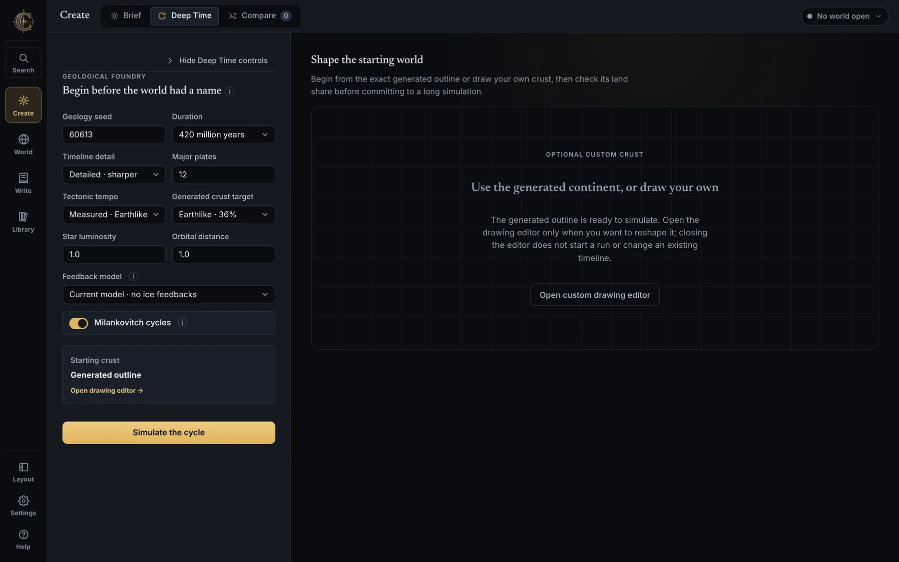
- Paint an initial supercontinent (or let one be built), run hundreds of millions of years of breakup, spreading, subduction, collision, suturing and erosion, then scrub every saved era with play, pause, four speeds, looping and a narration of each era's dominant events.
- Look ahead keeps the run going past the era the world is built from — 100, 200 or 400 million years — so the timeline shows where its plates go next. Keep a future era instead and the world is built there.
- Promote an era and the finished world inherits its plate inventory, welded groups, terranes, crust age and thickness, rift progress and relief — then runs the full climate, rivers, biomes, settlements, names and lore on top.
- Milankovitch forcing stores each era's tilt, eccentricity and precession; the promoted era carries that exact orbital state. Ice, isostasy & sea level (v1) is an opt-in feedback model that saves the era's elevation relative to its own sea level, so the world inherits an ice-age coastline.
- An import and a Deep Time era cannot be combined: they are competing foundations, and the app says so.
Reseed, replicate, build another like this
- Reseed this world (World tab, under How this world was built) builds a new world beside the current one from the same inputs under another seed, in three scopes: everything the seed decides, the story only (places of power, names, realms and lore on identical land) or the land only. Imported and drawn foundations travel across;
lineage.jsonrecords where the new world came from. - Build another like this loads a world's preset and settings into Create without the seed. Replicate a saved world with one click from its recipe.
- Every world writes a world recipe beside itself: seed, preset, every changed setting, the brief and thesis, nations, tectonic intent, output options and the imported or drawn foundation. One Save, one Export, one Import for the whole sheet.
World → Map
The map is the workspace.
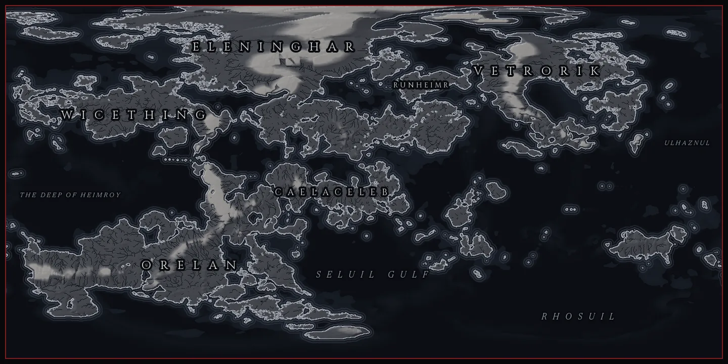
World is map-first: the rendered map is the page. A two-segment pill at the top left — World, Maps — opens the drawer beneath it, and everything that acts on the map lives in the dock along the bottom: View, Export, Tools, the zoom controls, Focus map and fullscreen. The Planet card floats at the top right and can be put away; the colour key and the coordinate line sit bottom left. Everything else is a mode that comes to the front when you ask for it.
Fifty-four views, one geography
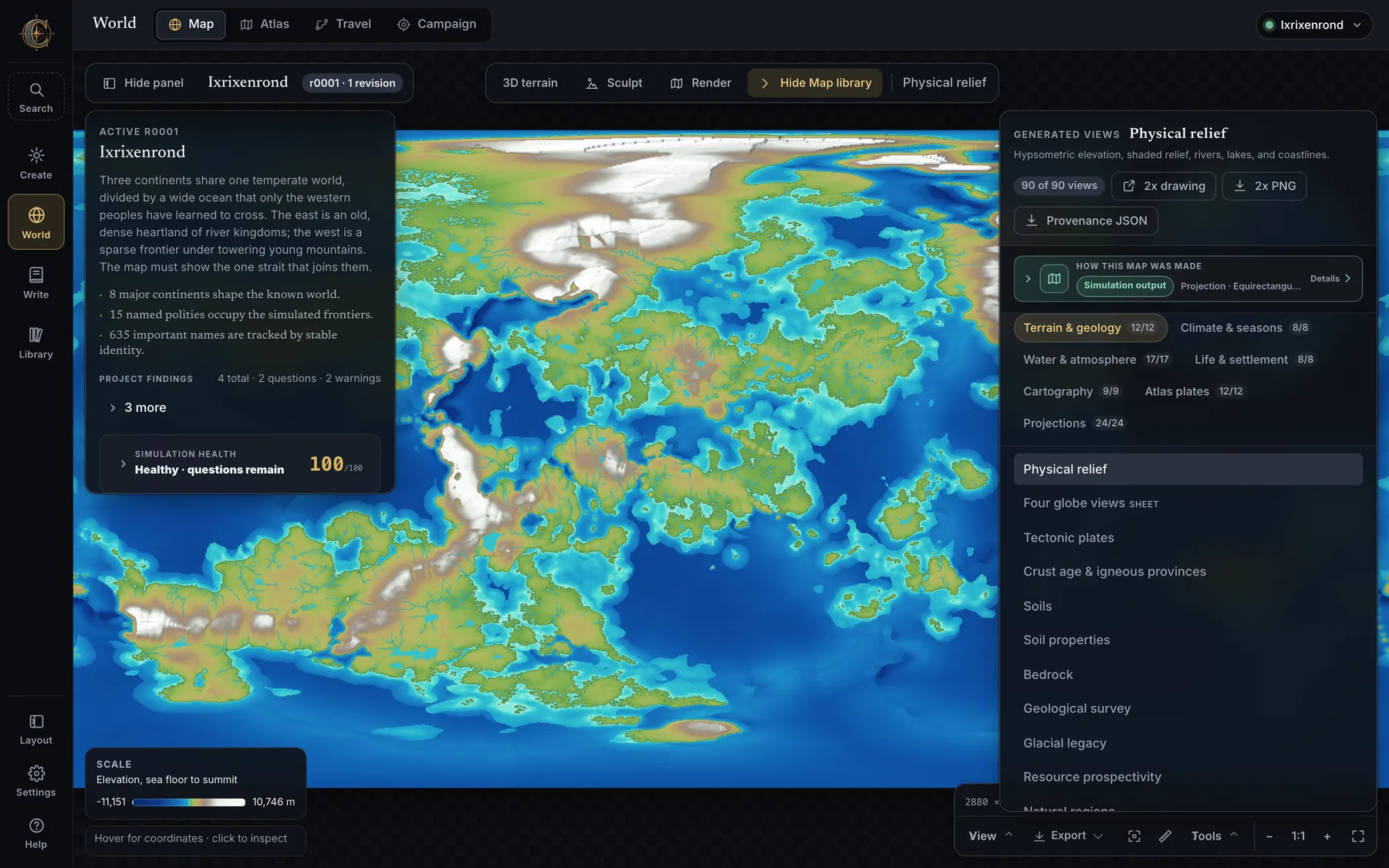
The Maps drawer groups every generated view — fifty-four standing sheets on a current world, plus one atlas plate per world, continent, region and city, and the projection products. Each has a reading key, a plain-language source method — Simulation output, Calculated from simulation, Planning estimate, Rule-based interpretation, Visual presentation, Author-edited layer or What-if preview — its projection, working scale, limitations and a downloadable Provenance JSON. Views whose saved fields an older world lacks are marked unavailable rather than invented.
| Group | Views |
|---|---|
| Terrain & geology (12) | Physical relief · Four globe views · Tectonic plates · Crust age & igneous provinces · Soils · Soil properties (fertility, depth, drainage, rockiness, organic carbon) · Bedrock · Geological survey (parent-material provinces with contacts, letter codes and structural traces) · Glacial legacy · Resource prospectivity · Natural regions · Mountain ridge systems |
| Climate & seasons (8) | Annual temperature · Annual rainfall · Seasonal range · Aridity · Köppen climate classification · Sea ice & winter extent · Seasonal temperature · Seasonal precipitation |
| Water & atmosphere (17) | Drainage area · Sea-level scenario explorer · Watersheds · Groundwater & aquifers · Water security & drought resilience · Moisture provenance · River hierarchy · Floodplain & settlement exposure · River permanence · Lake regimes · Ocean currents · Coastal tides · Maritime access & port catchments · Midwinter, spring, midsummer and autumn winds |
| Life & settlement (8) | Biomes · Realm territories · Border friction & trade dependence · Biome key · Settlement · Landmarks & routes · Domestication & farming · Agricultural calendar & growing windows |
| Cartography (9) | Tolkien sepia · Antique nautical · Modern atlas · Clean land & water base · Simulated realm territories · Black & white print · Grimdark · Swiss analytical relief · Vector sheet (zooms without blurring) |
| Atlas plates | Every illustrated world, continent and regional sheet, labelled and unlabelled, plus city plans |
| Projections | The same sheet drawn through the projection products |
- Show classes in the map key filters categories on soils, bedrock, resources, realms, biomes and hydrology; All, None and More/Less live there. Filters survive a change of drawing density and update the globe and the PNG download.
- The numbered agricultural cradles on the Domestication map are real controls: select one for its founder crops, package strength, ancestry and settlement influence.
- Every generated data view has a Why here? reading on click, and the Map source card's Provenance download says what kind of evidence you are looking at.
The cell inspector
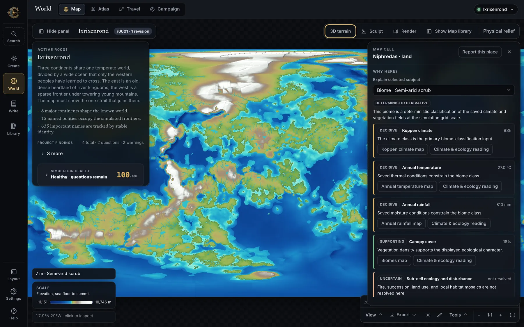
- Click any cell: elevation, plate and boundary type, climate, seasonal runoff and discharge, snowpack, groundwater, permafrost, watershed and depression IDs, stream order and channel form, lake depth and outlet status, biome, realm, settlement suitability and fantasy intensity. Metric or imperial units.
- Explain one climate cell — why it is warmer, colder, wetter or drier than latitude predicts: elevation, continentality, upwind terrain, moisture supply and the saved circulation, with the upwind moisture path traced on the map.
- Read the dossier for the settlement, realm, natural region or biome under the click, straight from the gazetteer.
- Rename the feature at the clicked cell, move or remove a settlement, or place a named settlement on any land with at least 20% saved suitability. Canonical names propagate to maps, dossiers, lore, routes, tongues and exports.
- The hover reading, the reading key and the coordinates stack without covering each other; the inspector retries with fresh data if a revision changes underneath it.
The pill, the dock, and the View and Tools menus
Since 0.9 there is no toolbar above the map. The pill at the top left holds the two ambient modes, World and Maps; the dock along the bottom holds View, Export and Tools, then zoom out, 1:1, zoom in, Focus map and fullscreen, with the resolution line above it. Nothing in any of them ever re-simulates.
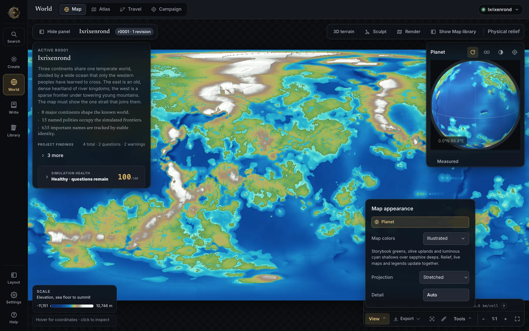
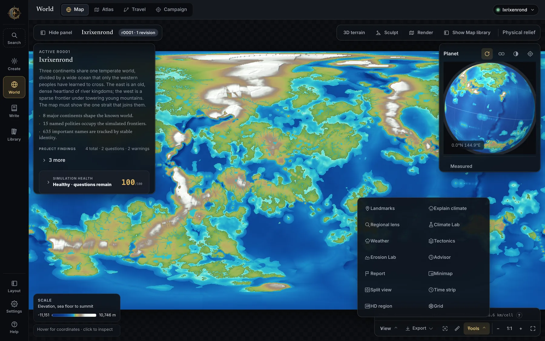
View — Map appearance
- Map colors — Natural (sage, sandstone, deep teal), Verdant, Parchment, Dusk, Tropical, Ember, Aurora, Illustrated (sapphire deeps, cyan shallows) and Classic. Each world remembers its own; live class swatches, continuous scales, world cards, globe textures and new Render Studio compositions follow.
- Projection — Stretched (the simulation's own equirectangular sheet) to begin with, then Equal Earth, Robinson, Mollweide, Mercator, and Two hemispheres: the Gott double disk sharing the equator as its rim, mirrored so coastlines meet when printed back to back. Overlays, hover readings and measurements land on the same spot in every projection, and since 0.9 choosing a projection no longer turns the world: the meridian a sheet opens at resets with the zoom and the pan each time a sheet is shown.
- Detail — Auto, Original, 2×, 3×, 4×. Continuous fields interpolate bicubically, categorical ones stay nearest-neighbour, river reaches redraw as vector lines weighted by discharge. The persistent badge states the simulated cell size, always.
- Planet — show or hide the globe card. Map aids — Minimap, Split view, Render, Time strip, HD region and Grid, which are presentation rather than instruments and so live here.
Tools
| Tool | Key | What it does |
|---|---|---|
| Measure | M | Great-circle distances on the sphere, not on the picture. |
| Landmarks | L | Roads, sea lanes, settlements, passes, places of power and your own landmarks on one sheet. |
| Explain climate | C | Choose a cell and get the measured causes of its climate, including the upwind moisture path. |
| Regional lens | R | A temporary close view centred where you choose. It can become a parent-linked child map with its own notes, pins and hand-drawn routes. |
| Report | — | Report something wrong with this map. |
| Turn world | — | Drag sideways to move the meridian the sheet is cut at, so a continent split across the edges can be brought to the middle. It is a mode you enter: off, a drag pans and a scroll zooms. 1:1 is the way home. Offered only to sheets that can carry a turn — an atlas plate's frame and lettering cannot be re-drawn about another meridian, and the tool greys out and says why. |
| 3D terrain | — | The saved terrain as a landscape, a voxel model, or a planet you can drag. |
| Sculpt | S | Raise and lower terrain before re-simulating. Below. |
| Render | N | Render Studio: a large layered drawing of this world. Below. |
| Climate Lab | K | Test how this world's climate answers a changed season, tilt or ocean — bounded, and without changing canon. |
| Weather | Y | Play a year of weather as a world-wide radar loop: rain, wind, pressure, storms, ice and tides. |
| Tectonics | T | The generated plates and boundaries, and which of your tectonic intentions were satisfied, compromised or impossible. |
| Erosion Lab | E | What erosion moved, and what it approximates. |
| Advisor | A | Planet Advisor: could this world exist? Plates, rivers, climate and biomes checked against each other, where people would thrive, and the chain from soil to polity as maps. |
- Landmarks remembers its filters locally, and a selected marker carries its lore, realm and culture context.
- Report shows a preview of exactly what would be collected — the current map or cell, expected versus observed, a short checklist — and nothing is uploaded on its own.
- Sea-level explorer, reached from the map's scenario views, is a bounded, reversible preview of coastline change and spherical exposed or submerged area. Canon is never touched.
Labs and the Regional lens
- Climate Lab — seasonal temperature, pressure, wind and rainfall frames to scrub; moisture-path inspection; located plausibility checks; a bounded what-if that estimates how selected climate controls would change the saved world, clearly labelled an approximation; and a review bundle (seed, resolved configuration, model response, findings) written locally for a specialist.
- Weather year — the saved seasonal climate as an animated year with a selectable frame count; a radar view follows precipitation and seeded storm systems; storm frequency, intensity and variability under a reproducible seed. Save it as a named weather sheet that Travel and the manuscript share.
- Erosion Lab — the same stream-power, hillslope-diffusion and floodplain-deposition kernel as generation, on a non-destructive coarse bench: before/after relief and drainage, what moved, mass balance. The world changes only on an explicit accept-and-re-simulate.
- Regional lens — click anywhere, or pick a named atlas region, for a wrap-aware high-density crop with measured elevation, temperature, rainfall, dominant biome, realm, resources, water and nearby lore; four layers and several radii, across the date line if you like. Regional downscaling refines a window at 2×, 4× or 8× with fine terrain, lapse-rate temperature, windward rain and re-solved drainage, labelled separately from the coarse truth.
- Promote a lens to a child map — a parent-linked regional project with stable world coordinates, inherited settlement and realm identities, its own notes, local pins and hand-drawn routes; refresh inherited features after the parent changes.
The Planet card and the 3D terrain explorer
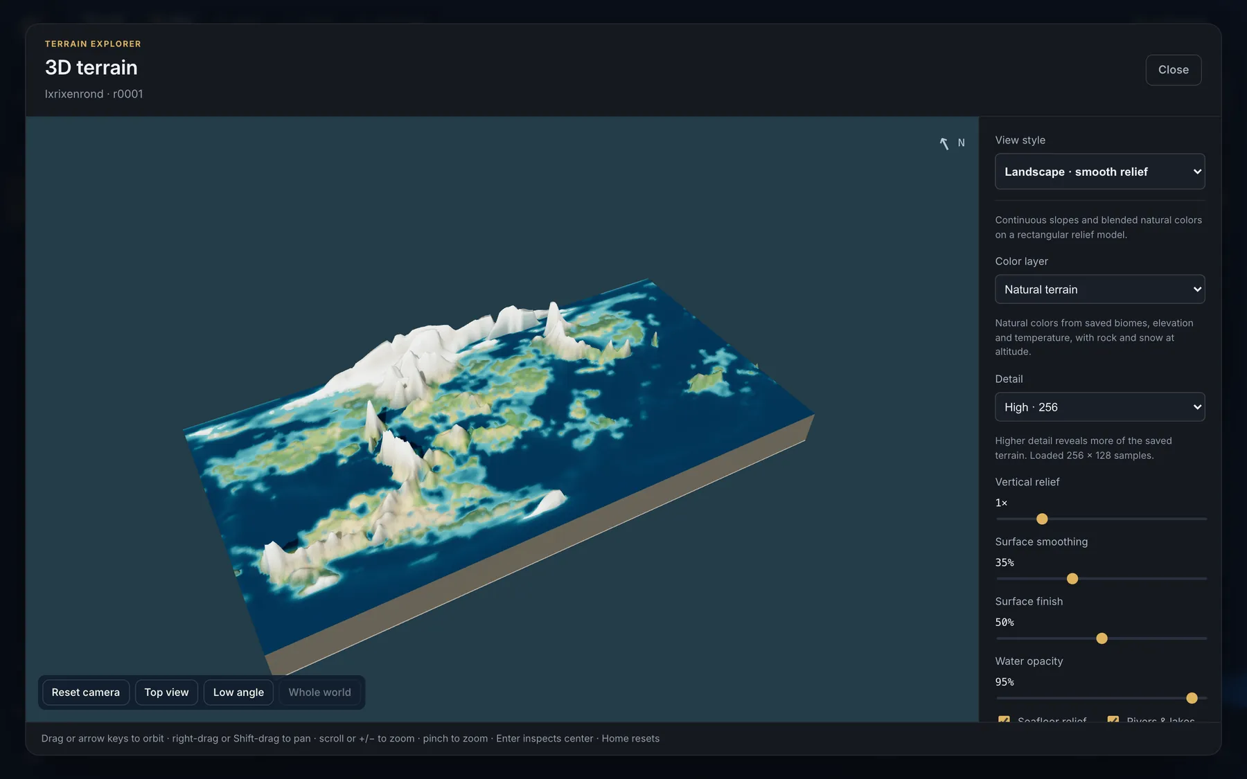
- Planet — a live globe in the corner with spin, a link to the map's centre, a light/dark printable background, and a switch between a sphere and two Gott disks you can drag around their shared axis. It hides independently of everything else. Its compass reports the place you are looking at rather than a heading: the globe's up vector is the planet's own axis, so north really is up, and the indicator is spent on the latitude and longitude beneath the centre of the view — “over the north pole” when you are straight down the axis.
- 3D terrain (Tools in the dock) — three views from one saved sample: a rectangular Landscape, a displaced-sphere Planet you can orbit into either hemisphere, and Voxels in 100, 250, 500 or 1,000 m terraces. Detail presets from 96 to 2,048 samples on the longest edge; natural colours or biome, elevation, realm and climate palettes; vertical relief, smoothing, seabed relief, water opacity, rivers and lakes; sun direction and lighting presets; perspective, orthographic, top and low-angle cameras; an inspector that always reports saved cell values; PNG export of any view. Select a region on the planet to open it as a landscape. Rendering is local, in a worker, and never exceeds the saved simulation grid.
Sculpt, Select feature, revisions
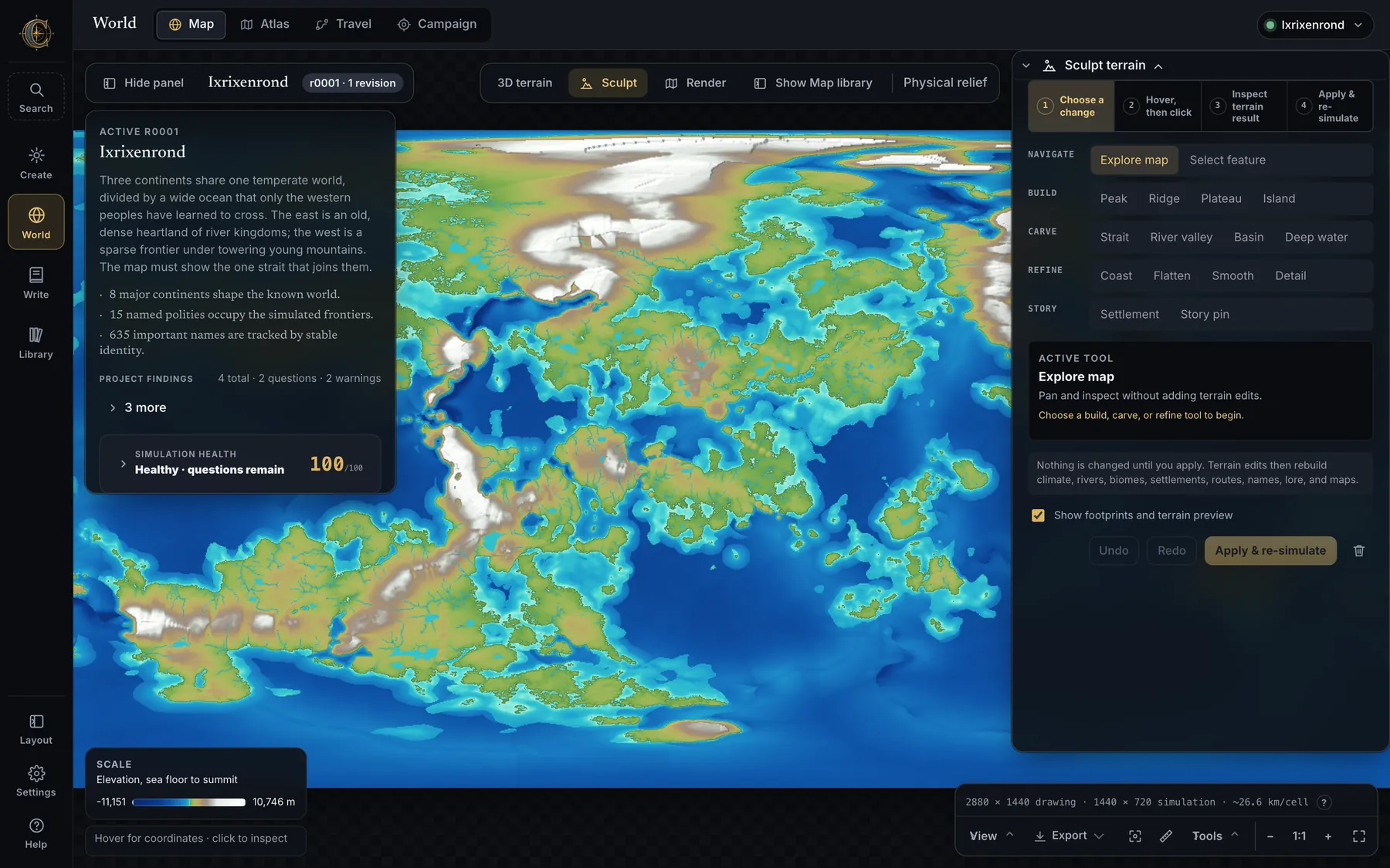
- Sculpt — Peak, Ridge, Plateau, Island, Strait, River valley, Basin, Deep water, Coast, Flatten, Smooth, Detail, Protect area, Preserve terrain, Settlement, Story pin and Describe a region. The brush previews its footprint, falloff, bearing, radius, cumulative elevation delta, affected area, raised and lowered cells and provisional coast crossings on the map before anything is applied; several operations stack with undo and redo.
- Sculpting with your hands 0.9 — a click places the brush exactly as the panel describes it; holding the pointer and dragging states the footprint in kilometres on the map itself, and releasing hands the pointer the height, with both numbers read out beside the cursor as they change. A painted stroke is a row of ordinary nudges spaced on the ground rather than on the screen, so the same gesture means the same thing at any zoom. Ridge and River valley are drawn as trails: click each peak or bend in turn, hold any one of them to give that summit its own height, and finish on the last point — the whole crest is one edit, previewed, undone, listed and re-simulated as a single record.
- Describe a region 0.9 — draw a circle or a square on the map and say what belongs there. A description naming something CartoVox can place gets it placed: a named region on the map, a page in the codex, an entry in the gazetteer, carrying your own words as its lore. Where the words describe ground rather than a landmark — volcanic, highlands, sunken — the ground moves, through the same sculpt records a hand edit would have written. Words it read and could not place are reported back rather than silently dropped.
- The places you put on the map stay put — cities and borders you draw hold their positions against the world's own, instead of being displaced by the generator's next pass.
- Select feature reads the editable terrain, water, ecology, settlement, route, realm and magical-region features under a point. Remove or reshape land, islands, lakes, rivers, biome regions and mountain terrain; move or remove settlements; reshape routes and realm borders; edit magical regions. An operation that cannot honestly preserve a generated feature says so and stages the closest supported change.
- Re-simulate states which downstream systems will be rebuilt before it runs, uses the world's recorded seed, can be cancelled while it is still safe, renders new plates in staging and swaps them only when they exist. Every apply creates a restorable revision under
revisions/r####/; author canon, locked names and lore overrides survive it. - Checkpoints can be named; continuity diffing after a sculpt reports what moved: planet stats, landmass areas, hearth movement in km, realm territory shares and any name that changed.
- A world being rebuilt no longer looks finished. Applying terrain edits marks the project Rebuilding edits in the Library while the work is in flight, so a force-quit at hour two cannot leave an entry offering every action over a world whose maps and archive no longer agree. A failure before the commit restores the project; a failure after it reports the project as incomplete; a force-quit is reconciled on the next start.
Simulation health and provenance
- Simulation health scores a world out of 100 with evidence-backed findings about tectonics, climate, terrain, biomes, rivers (reaches flowing uphill, branching outside the dendritic band, Hack's exponent) and data integrity. View jumps to the layer and cell; Prepare repair stages a conservative sculpt or focuses the exact generation setting, and the resulting revision records whether the finding resolved, improved, persisted or worsened.
- How this world was built — seed, preset, grid, whether it came from an import, a Tectonic Director intent or a saved geological history, and the handful of settings that differ from the preset; whether the illustrated atlas can still be created; Build another like this; Reseed.
- Project findings distinguish generated facts, inferred material, author canon, unavailable data and deliberate open questions.
Render Studio
One custom whole-world composition at 1K, 2K, 4K, 8K or tiled 16K, delivered as documented transparent PNG layers with world files, a compositing manifest and a flattened preview. It says what it creates before it renders, and it never claims a bigger drawing is a finer simulation.
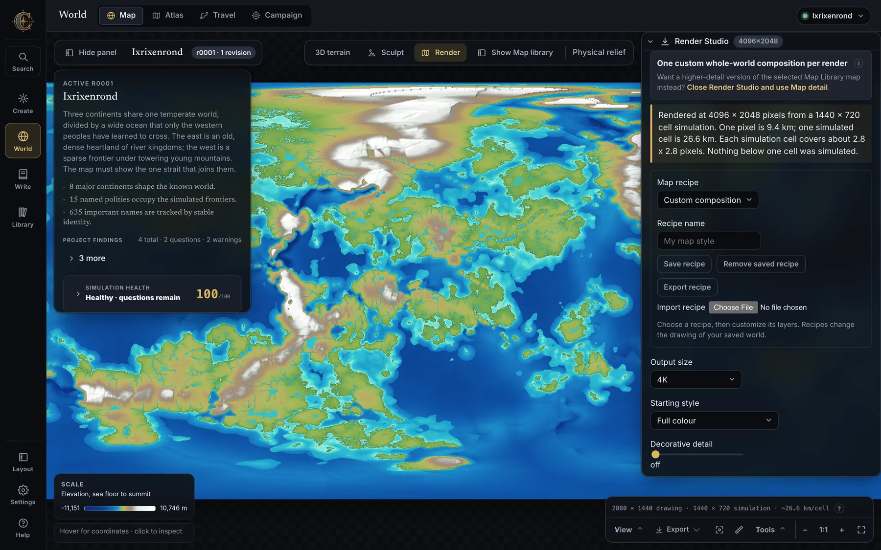
- Nine recipes — Physical atlas, Pastel kingdoms, Banded heightmap, Biome atlas, Antique parchment, Survey blueprint, Print outline, Pure landmass and Illustrated realm. Save named recipes on this device or share them as small JSON files with their stamps embedded.
- Layers — ocean with depth bands, land, biomes, relief, lakes, rivers, coastline, borders, realm colours, land-elevation contours, graticule, labels, settlement symbols, compass rose, equatorial scale bar, vignette, roads, sea lanes, landmark symbols, and the illustrated layers: painted land cover, mountains/hills/volcanoes, forests, mountain mist. Reorder them; set opacity, colour, line width, size and label halos; choose grayscale or sepia; keep alpha in transparent exports.
- Illustrated realm paints watercolour land cover with snow above each biome's snowline; places original hand-drawn mountains, hills, volcanoes with glowing craters, conifer, broadleaf and tropical trees, dead trees on ash and blight, reeds in wetlands; cracks ice into floes and salt pans, ripples dunes, streaks grassland, shows reef shallows. Glyphs are placed from the world's own seed so a 1K preview carries the same forests as the 16K export.
- Titles and captions — positioned text that can rotate, curve up or down, use its own typeface and tracking, or follow a copied drawing path; click the preview to place a caption, compass or scale bar. Place-label editing — search a saved name, change its display text, typography or size, hide it, or nudge it, without touching the canonical name or the settlement's position.
- Stamps and shapes — a decoration canvas with twelve original vector symbols, imported PNG/JPEG/WebP stamps organised into shareable art packs, freeform paths, polygons, Bézier curves with editable handles, brush strokes and soft dabs with Normal, Multiply or Screen blending, eraser objects and paintable masks, textures and shadows, groups, snapping, canvas zoom, 40 steps of undo, and full keyboard control. Up to 200 objects per recipe.
- Scene paper — editable keep-interior, woodland-encounter and village-square layouts with square or hex encounter grids, colours, spacing and author units, on paper that keeps its drawing scale.
- Oblique view 0.9 — beside every finished render that can carry it. Every sheet CartoVox draws is a plan view; press this and the sheet tilts until the terrain has a far side, so ridges stand up, valleys go behind them and the coast has a horizon. It tilts the finished sheet rather than each layer, so nothing comes apart: a river is still in its valley and a name is still on its town, because they are the same pixels, carried with the ground they name the way a hand-drawn panorama does it. How tall the mountains stand is asked for as a share of the picture rather than as a multiplier, the sides of the terrain are shaded so you can see which pixels are the map and which are the camera's, and the scale bar, compass and graticule stay flat on the paper — a scale bar bent over a hill would promise a measurement the picture cannot keep. The picture says so on screen and inside the PNG: horizontal distances are the map's, vertical ones are not to any scale. Your render is untouched; the oblique is a separate picture beside it.
- Bundles include
captions.svgandobjects.svgbeside the PNG layers, so lettering and artwork stay editable; render manifests record the appearance and palette for reproducibility. Relief depth — cast shadows and sky openness — changes 0.5% of land on a whole-world sheet and 22.5% at regional scale, which is where an escarpment finally throws a shadow across the ground below it.
Everything that exports
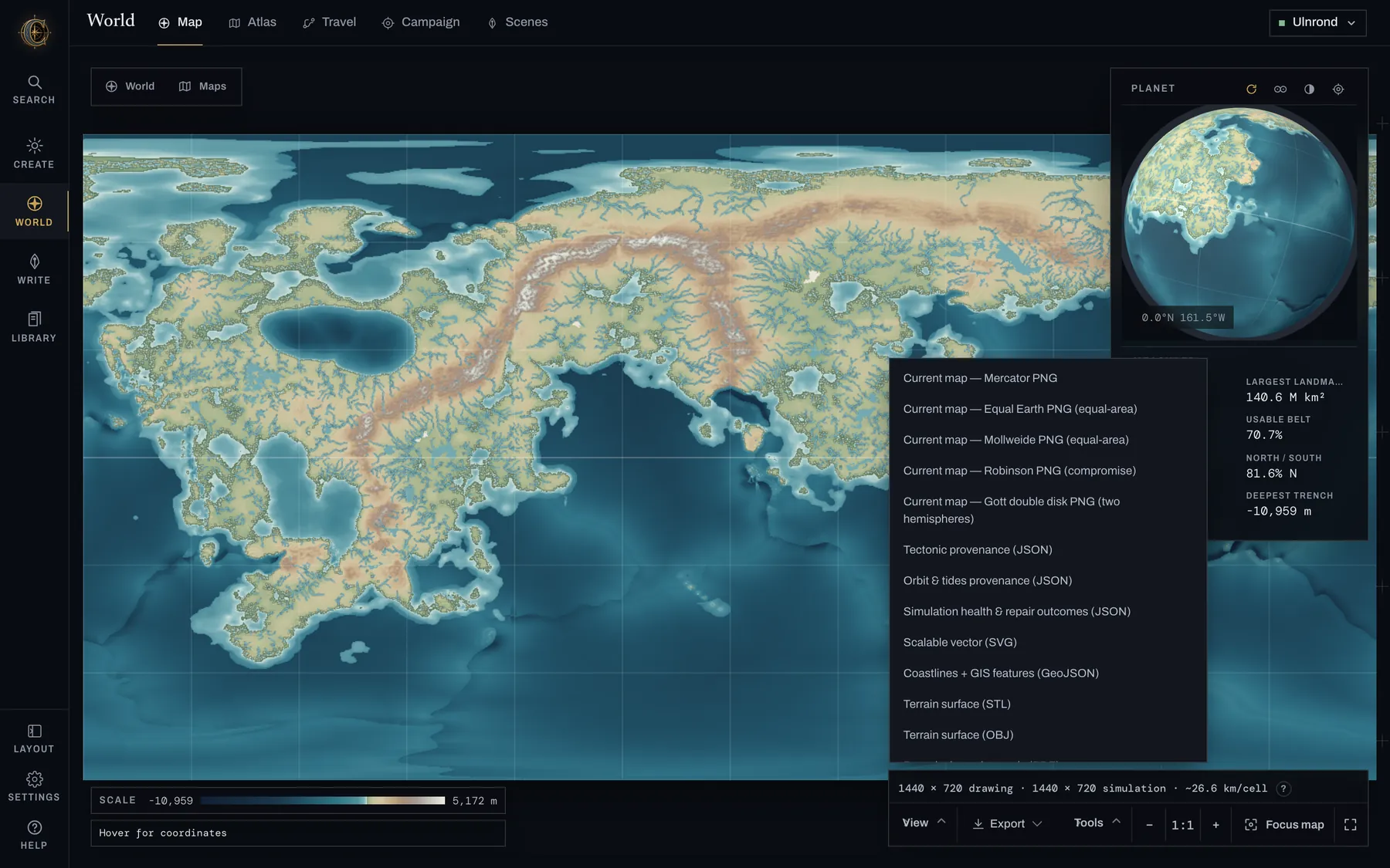
World › Export, sixteen entries. Everything else leaves from the panel that owns it.The map dock's Export menu, plus the downloads scattered through the Codex, Atlas and manuscript. Nothing here needs a re-simulation.
| What | Where | Notes |
|---|---|---|
| Any map view as PNG | Map · Export | In the current projection and palette, with filters applied; Original PNG for the raw sheet |
| Coastlines + GIS features (GeoJSON) | Map · Export | Real coastlines 0.9: landmasses as polygons with lakes and inland seas as holes, split at the antimeridian as RFC 7946 asks. One saved world exports as 260 landmasses with 159 holes in less than half the bytes of the 8,899 rectangles it used to emit, and rasterises back onto the grid agreeing with the saved land mask to 99.94% of cells |
| Terrain surface (STL / OBJ) | Map · Export; Draw | Open Z-up surfaces in metres including seabed; rescale and add a base for printing. The whole grid by default since 0.9 — about 2.07M triangles and 99 MB for a Full world, where the old fixed cap took 3.2% of the cells and said nothing |
| Vector bundle (SVG) | Map · Export | Layered marching-square coastlines and the canonical river geometry; the unlimited-sharpness option |
| Scientific data bundle | Map · Export | Numeric GeoTIFFs with TFW/PRJ georeferencing and a custom spherical CRS, data dictionary, provenance, GeoJSON and the lossless world_data.npz for QGIS or NumPy |
| Provenance JSON | Map source card | The evidence class, method, projection, scale and limits of the view you are looking at |
| Web Mercator sheets | Map · Export | Square relief and biome exports under projections/mercator/ |
| Render Studio bundle | Render | 1K–16K layered PNGs, world files, manifest, captions.svg, objects.svg, flattened preview |
| 3D terrain PNG | 3D terrain | Any camera, any view style |
| Illustrated atlas plates | Atlas | World, continent and regional sheets at up to 4800 px, labelled and unlabelled, and city plans |
| Bound atlas, print-ready (PDF) | Map · Export | 0.9 A title page with your world’s name and your own thesis, a contents list, a page for every plate at a real paper size and a colophon that carries the seed. A wide plate turns the page to landscape on its own; every plate is embedded at its own resolution and the export reports the dots per inch page by page. The contents page is searchable text, lettered in the faces the plates use. The colophon says what the file is not: sRGB throughout, no CMYK separation, no ICC profile, no crop marks, no bleed |
| Settlement as a battlemap | Settlement Studio | 0.9 Universal VTT (.dd2vtt) or a Foundry scene, with walls, doors and line of sight decided from the plan |
| Climate review bundle | Climate Lab | Seed, resolved configuration, model response, findings |
| Weather sheet | Weather year | A named year of frames Travel and the manuscript can share |
| Campaign export | Campaign | Player-visible material and journey timelines as Markdown |
| Obsidian vault (.zip) | Codex | Overview, timeline, religions, trade, hooks, one page per realm, culture, place of power and settlement, Tongues.md, the series bible, your novels |
| Scrivener transfer · Ellipsus transfer | Codex | Writing and Codex material as a Scrivener-shaped project, or an Ellipsus-compatible bundle |
| Realm handbooks (.zip) | Codex | One handbook per nation: government, capital geography, biome mix, named features, allies and disputes, trade, every event and hook, a writing checklist |
WORLDBOOK.md | Codex | The measured dossier, including every name with its roots, meaning and pronunciation |
| Book exports | Manuscript | Word (.docx) with running headers, page numbers, embedded maps, real footnotes and tracked changes; Markdown; Scrivener package; self-contained web page; EPUB 3 |
| Insights report | Manuscript | CSV per table, Markdown and JSON |
Project backup (.cartovox) | Library · Map | The complete round-trip project: fields, products, revisions, lore, campaigns, Chronicle, regional state. Import it from the Library under a fresh identity |
| World recipe · custom theme · Render recipe · art pack · tracing draft | Various | Small JSON files for moving authored work between machines |
- Other page sizes for the bound atlas. A5, A4, A3, Letter and Tabloid all work; the menu always
asks for A4. The export is a local address ending
/export/atlas_pdf?page=a4, and changing thata4binds the same plates at that size — tested, but it means typing an address rather than pressing a button. - Half, quarter and preview mesh detail. The menu exports the whole grid, which is what most people
wanted and never had. The smaller sizes answer to
?detail=half,quarterorpreviewon the same kind of address, and each one downloads under its own name. - Regional render windows. Render Studio can draw a north/south/west/east window of ground rather than the whole planet, but the panel has no control for it yet — every sheet you can start from the panel is the whole world.
World → Atlas
The illustrated atlas
Painted base, inked coastlines, terrain built from stamped symbols — drawn from the saved fields, so terrain, climate, rivers, settlements, names and lore are never re-run for a sheet.
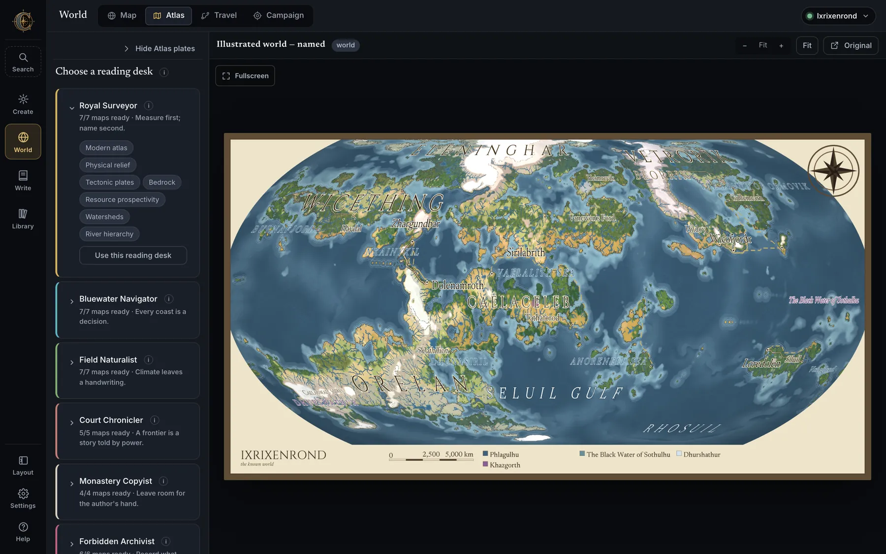
- Three scales, three languages — a world sheet (>12 km/px) paints biomes, inks the coast, draws great rivers and city dots; a continent sheet (4–12 km/px) adds ridge-aligned peaks, forest masses with decorated edges, realm tints and named rivers; a regional sheet (<4 km/px) uses the full stamp language, interior forest, third-tier towns, ports and the keeps that hold the passes.
- Nothing invents geography — peaks follow the ridgeline with snow above the local snowline, trees follow canopy and switch species by biome, dunes follow the ergs, volcanoes sit on real arcs, rivers carry width from real discharge, and deltas appear only where the hydrology reports one.
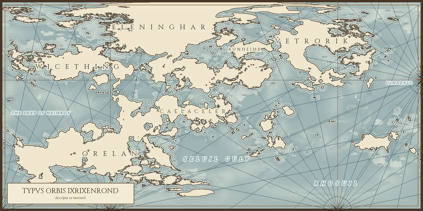
- Coast and sea — a crisp inked shore, a pale halo, concentric hachures, the shelf break, engraved isobaths and a faint portolan rhumb web. Gulfs, bays, inland seas and straits are found by closing the coastline at 760 km and named by measurement, so a strait is called a strait because it measures like one.
- Type — four sizes, three treatments: water italic, political tracked caps, physical small caps; river names set glyph by glyph along the channel. A name that cannot satisfy the neat line, its feature mask and the busyness under it is dropped and reported; nothing overlaps.
- Eight style sheets — Tolkien sepia, Swiss analytical relief, modern atlas, antique nautical, working ink, grimdark, the clean land-and-water base and a political sheet — plus a realm map grown by travel cost and a vector sheet that zooms without blurring. They are drawn beside the plates and appear under Cartography in the Maps drawer.
- Six reading desks — Royal Surveyor, Bluewater Navigator, Field Naturalist, Court Chronicler, Monastery Copyist, Forbidden Archivist: curated sets of views for a purpose, each listing only what actually exists for this build.
- Labelled and unlabelled variants are grouped under one sheet name; redraw the lettering after a rename, add the missing variant later, or Create publication atlas for a world built without one. Render remaining plates finishes a stopped run.
- City plans — a plan per major settlement, drawn from its site, and available to the manuscript's Insert map.
- The impossible layer — blighted wastes downwind of settled country, ashlands downwind of volcanoes, firelands on young rock, fungal forests in hot wet closed canopy, silverwoods deep in old forest, frostbound reaches, glass wastes on desert floors, floating isles over broken crust, drowned ruins on the shelf, a maelstrom in deep water — each placed by rule with its cause in the dossier, leylines joining them as a spanning tree. Switch it off entirely or drop one kind.
- Map gallery in the Library shows every plate, style render and city plan from every world on one wall, newest first, filterable by world, kind and lettering, with a lightbox and a jump to the sheet's own Atlas tab. A sheet drawn before a later edit says so.
World → Travel
The Journey Laboratory
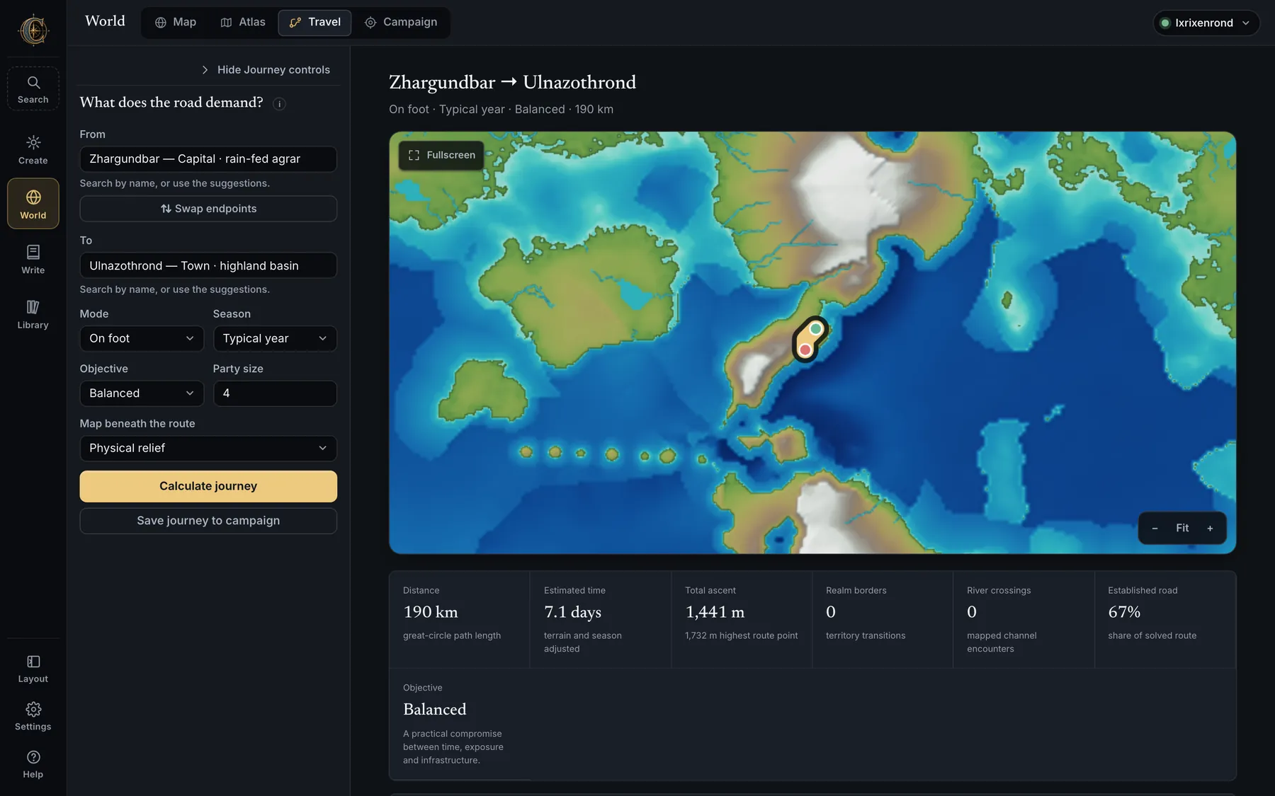
- From / To any named settlement, with suggestions; Swap endpoints. Mode — on foot, horseback, caravan or sailing ship. Season — typical year or a specific one from a saved weather sheet. Objective — Balanced, Fastest, Safer or Trade-minded. Party size. Map beneath the route — any physical view.
- Land journeys report distance, time, ascent and descent with an elevation profile, realm borders crossed, river crossings, established-road share, dry stretches, food, water, fodder and reserve capacity — and say when a route needs staged caches. Market stops, local goods, toll exposure and expected border delay are named.
- Ship journeys use nautical analytics instead: wind and current assistance, open-water legs, port intervals, sea hazards, cargo and potable-water capacity.
- Journey weather follows the trip from its departure day to its wind-adjusted arrival; routes beyond the 400-day planning window still solve and say why forecast detail is unavailable.
- Alternatives can be selected as the active result; Save journey to campaign keeps it as an authored story track whose gold handles can be dragged on the map.
- Routes take the cheapest ground — slope, altitude, marsh, river crossings, magical hazards, resource provinces — which is why they hug valleys and find passes, and why realm frontiers fall on ranges and straits.
World → Campaign
The Campaign desk
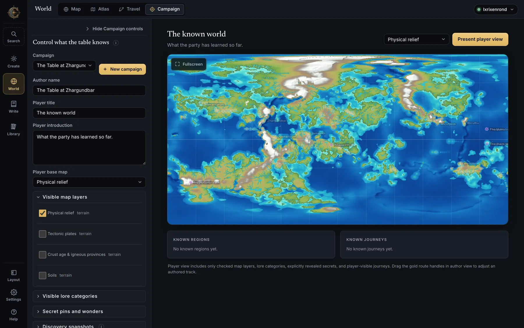
- Profiles — several per world, each with an author name, player title, introduction and base map. New profiles reveal only relief by default.
- Visible map layers and Visible lore categories — tick what players may see. Secret pins and wonders reveal individual places only when the story reaches them.
- Known regions and Known journeys — saved Regional lenses and solved routes attached to the campaign.
- Discovery snapshots — save the world as the party knows it at a point in play and compare two snapshots to see what became known.
- Present player view — a focused presentation that hides the authoring interface and survives reload, restart or crash; only Exit presentation clears it. Player-region links are inert while presenting.
- The Chronicle can lend the campaign its eras, and journey weather rides along with saved journeys.
Settlement Studio
Villages and towns, planned street-first
The generator used to choose an outline and scatter buildings inside it, so every village
came out as the same blob of unaligned boxes. It now lays the street network first, takes
the blocks those streets enclose, divides each block into plots, and fits a building to
each plot facing its street. The settlement's outline is whatever the finished blocks add
up to. Open it from World › Scenes, or from Library › Scenes and encounter maps,
with Create or import settlement.
The plan comes from the world
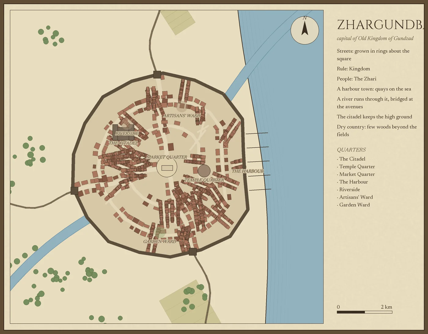
- Eight plans that differ in structure, not in jitter — street village, green, crossroads, radial, organic, harbour, hilltop and twin neighbourhoods. Which one you get is chosen from the approach roads, water and relief the saved world already records.
- Quarters set their own rules — market, green, craft, townhouse, gentry, manor, temple, dockside, poor quarter and crofts each carry their own plot size, coverage, setback and building forms. Poor quarters deliberately do not line up, and are grown as one district.
- Every plot faces a street, and every building on one side of a street sits on a shared frontage line, so a row reads as a row.
- Water and roads load automatically from the saved hydrology: the river's real width, ponds, springs, public wells, the mapped groundwater area and the regional approach directions. Every value stays changeable under an explicit override, and Reset restores what the world says.
- The countryside scales with population under an editable land budget: connected farms with strip fields and furrows, readable crop types, orchards, hedges, working buildings and biome woodland. The sheet is sized from the settlement, and the hectares beyond it are reported rather than drawn.
- Bridges are chosen, not sprinkled — roads and walls stop at the water's edge, ordinary roads pass beneath surface water, and river crossings are a spaced set picked by road importance and span. Wall gates appear where roads actually cross.
- A 40,000-person city generates in about a tenth of the time it used to take.
Artwork that is drawn, not stretched
- Roofs are built from each building's own footprint, with ridges, hips and courses, so an L-shaped or long narrow house gets a roof that fits it. Previously one of six drawings was squashed to whatever rectangle it was given.
- Fifty-seven pieces, up from thirty: eleven tree species, windmills, watermills, granaries, forges, chapels, gatehouses, fountains and troughs, beehives, livestock pens, woodpiles, fences, shrines, stocks, boats, jetties, and vineyard, flax and fallow field treatments.
- Three art directions — Illustrated adventure by default, with engraved and tabletop beside it, matching the application's own.
- Scenery behaves — orchard trees keep their proportions in irregular plots, crop rows follow field boundaries, woodland forms uneven groves, and useful scenery sits near buildings or fields.
Designing one by hand
- Steer the generator — street density, plot size, building coverage, irregularity, the share given to poor quarters, and how far the countryside reaches.
- Choose artwork by looking at it — a picker showing the drawings themselves, filtered to what the chosen feature can actually use, with search and an explicit automatic option.
- Place features on the canvas and have them turn to face the nearest street, or scatter a copse of trees in one click that undoes as a single step.
- Draw a quarter on the map and rebuild only that part. The streets and every building outside it stay exactly where they are.
- Edit anything — move, reshape, style, label, add and delete buildings, trees, fields, roads, water and defences, with undo. Edited geometry stays paired with the SVG, PNG and tile exports.
- It explains itself — which planner is active, why a control is unavailable, what each colour channel paints, and an unsaved draft you can restore from the first screen.
Settlements you can play on 0.9
- Universal VTT (
.dd2vtt) — walls, doors and the map image in one file, read by Foundry through the Universal Battlemap Importer, by Roll20 through the community importer, and natively by Fantasy Grounds and Arkenforge. The file carries its map image and declares the pixel density that image actually has rather than the one a tabletop would prefer. - Foundry scene — the same plan as a scene Foundry opens with no module at all; the image travels beside it.
- What blocks sight is decided, not guessed — buildings, town walls, towers and rock block line of sight; fences and pens go in the objects list instead, because a waist-high fence stops a cart and not a view; gates become doors that open; roads and fields are not obstacles.
- Choose your square — five feet, ten feet, one metre or two. A settlement is as large as it is, and the export tells you how many squares that is before you open it somewhere it will not fit.
- Only forges are exported as lights. A forge is a fire and the simulation says so; nothing else in a CartoVox settlement is a light source, and a lantern hung on every door would be invented by the exporter rather than known. The rest is the referee's to place, and the export says so.
Regional data guides local design. Exact street-level terrain and river banks are authored approximations, not simulated at that scale, and the food-supply report states planning assumptions rather than measured yields.
Scenes and encounter maps
Maps with no world behind them
A scene is a map that does not need a planet: a keep interior, a woodland encounter, a village square. Create them from the Library, and they get saved documents, versions, PNG and SVG rendering, portable backups and recoverable trash like everything else.
- Canvas — square, landscape or portrait, with local author coordinates instead of geography, and square or hex encounter grids with your own colours, spacing and units.
- Nested scenes — parent and child hierarchies up to eight levels, with breadcrumbs, child navigation and clickable hotspots that carry you from one scene to another. Export and import a whole connected tree.
- Drawing layers — up to 32 named layers with saved opacity, Normal, Multiply or Screen blending, and non-destructive erase and restore masks that stay inside their own layer.
- Lighting — Warm interior, Moonlit exterior and Dusk moods; add, drag, name and tune up to 32 lights; adjust overall darkness and shadow colour. It is authored atmosphere, and the app says so rather than implying simulated visibility.
- Height and shadow 0.9 — tell a scene how tall each thing is and it casts a shadow. A wall, a tower, a fallen column, a table: give it a height in your scene's own feet or metres and it stands up, so a standing tower and a collapsed one stop looking the same. One sun for the whole sheet, because that is what makes a page read as having depth — twelve drop shadows set by hand that disagree about where the light is do not, however deep each one looks. Twice as tall is twice as long a shadow, taken at life size and not stylised, so a wall shadows the rubble beside it and a narrow alley sits back from an open courtyard. What stands is what you drew: an unfilled rectangle is a room's walls and casts a wall's shadow, a filled one is a solid block, and if your floor and your walls are one filled shape the control says so by name and tells you how to separate them. Nothing tilts — every footprint stays exactly where you drew it, the grid still measures, and a token still stands on the square it is on. It is off until you ask, and the sheet says in plain words that the heights are yours rather than measured.
- Art directions — Illustrated adventure, Engraved parchment or Clear tabletop applied to palette, linework, lettering, markers and atmosphere as a single Undo step, previewed before it touches the document.
- Original vector kits — village exteriors, stone fortifications, terrain and landscape, and rooms and furnishings: cottages, longhouses, workshops, shrines, market stalls, wells, gardens, carts, curtain walls, towers, gatehouses, bridges, groves, boulders, reed ponds, fords, beds, tables, hearths, bookcases, chests and rugs.
- A shared library — save any artwork or assembled structure to an on-device catalogue with previews, names and tags, reuse it in any world or scene, and share it as an art pack.
- Drawing tools — Select, Stamp, Path/wall, Area, Brush and Erase with a contextual inspector; Bézier paths with editable handles; groups nested eight deep; snapping with alignment guides; resize and rotate on canvas; align and distribute.
- Reference images — drop a full-detail PNG or JPEG beneath the artwork, or calibrate one onto a whole-world sheet by matching two image landmarks to two world locations.
- One 40-step Undo across world maps and scenes: artwork, captions, layers, masks, lettering, appearance, recipes, canvas and output settings all follow the same labelled timeline.
Write → Codex
Codex and lore
Measured geography, suggested lore and your own decisions in one place. Generated social history is a proposal until you accept or rewrite it; everything you write survives re-simulation.
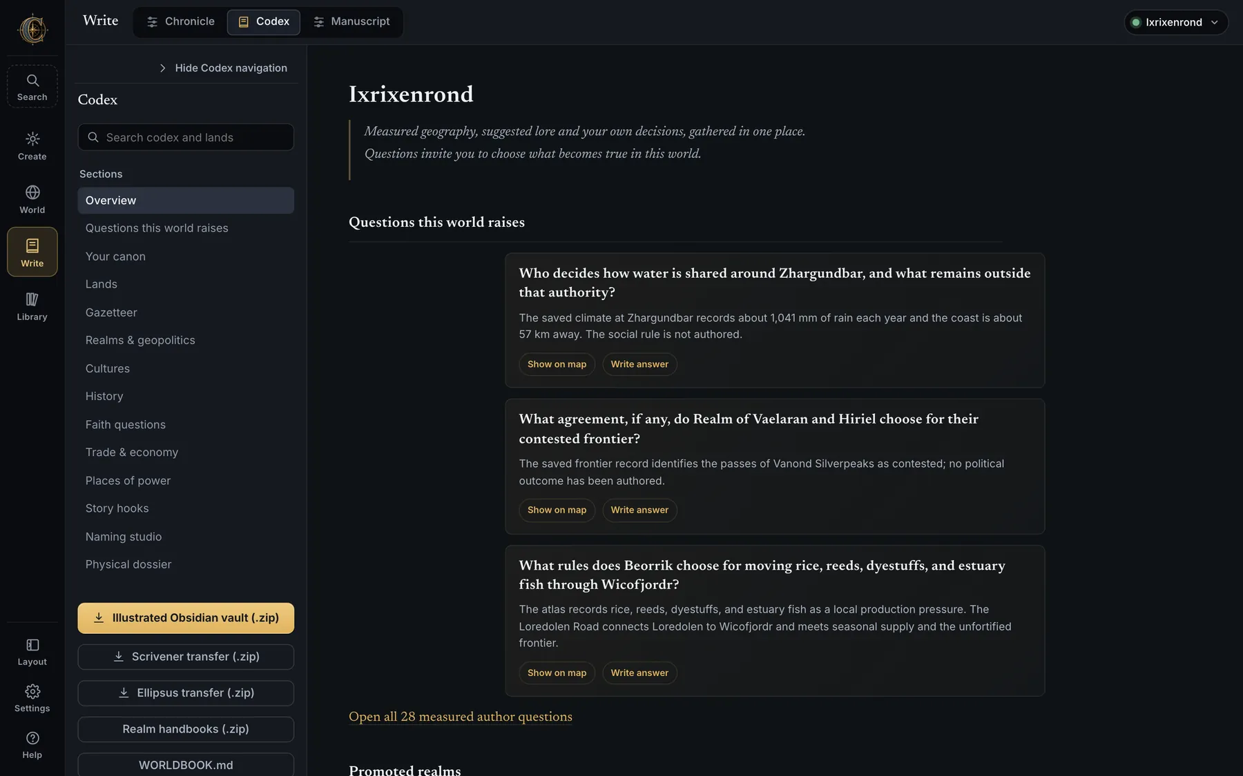
- Seventeen sections — Overview, Questions this world raises, Your canon, Import lore, Lands, Gazetteer, Realms & geopolitics, Cultures, History, Faith questions, Trade & economy, Places of power, Story hooks, Naming studio, Rename everything, Describe everything, Physical dossier.
- Questions this world raises — measured author questions the simulation cannot answer (who decides how water is shared, what proves a right to the frontier), each with Show on map and Write answer. They are a first-class writing surface, not empty sections.
- Rename everything 0.9 — every named thing in the world on a single editable sheet: realms, cultures, faiths, places of power, settlements. A canonical name propagates through maps, dossiers, lore, routes, tongues, exports and later revisions.
- Describe everything 0.9 — the prose of the world in one place: every realm's government, motto, strength and weakness, its ruler's title, character and secret; every culture's diet, burials and taboos; most of every faith; and cities and towns, whose descriptions are read back in the dossier, the vault and search. The generator leaves prose blank rather than inventing it, so a typical world ships with about a hundred empty fields — questions left open, not missing data — and the sheet says how many and can show you only those. Measured findings are left alone: a place of power's kind is read off the simulation, so the sheet does not offer to edit it. Before 0.9 exactly two fields out of twenty-six were reachable, a realm's motto and its ruler's name, one realm at a time.
- Lore Editor (under Your canon) — rename the world or any realm, city, place of power, culture, religion, continent or ocean; append timeline events, story hooks and private notes; or paste raw JSON. Renames rewrite every cross-reference and are idempotent at name boundaries; lore, handbooks, the worldbook, GeoJSON, SVG and the vector bundle refresh together, and raster labels are marked for a later redraw.
- Naming studio — every name with its stable feature ID, generated form, pronunciation, gloss, alternatives, lock status and reader-confusion audit. Names come from language families whose morphemes carry meanings (khaz — stone-born); a glacier is built from words for ice, a name that collides with somewhere a reader has heard of is refused, and border rivers are named twice, once in each bank's tongue. Name review lists high-conflict names to settle.
- Lands — one connected page per natural region with terrain, climate, water, neighbours and lore, reachable from the map, search and the Codex.
- Gazetteer — a writer's dossier for every settlement, realm, culture, tongue, continent, natural region, range, desert, biome, river, lake, sea and place of power: where it is and what it is like, the name's roots and the names it nearly had, a season-by-season table of temperature, rain, daylight and wind, the river at its door and how it floods, soils, crops, ore and groundwater, who holds it, the sky and calendar, neighbours with distances and travel days by foot, horse, caravan or ship, landmarks within reach, and every hook, question, faith, trade route and event that names it. A sensory palette turns measurements into what a character would see, hear, smell and feel. Every fact carries its status: measured, derived, suggested, canon or prompt. Write with it carries a dossier into the manuscript.
- Characters — private pages under
codex/characters/with aliases, pronouns, home, realm, culture, tongue, birth and role; they become gazetteer entries the manuscript recognises. - Downloads — the Illustrated Obsidian vault, Scrivener and Ellipsus transfers, realm handbooks and
WORLDBOOK.md.
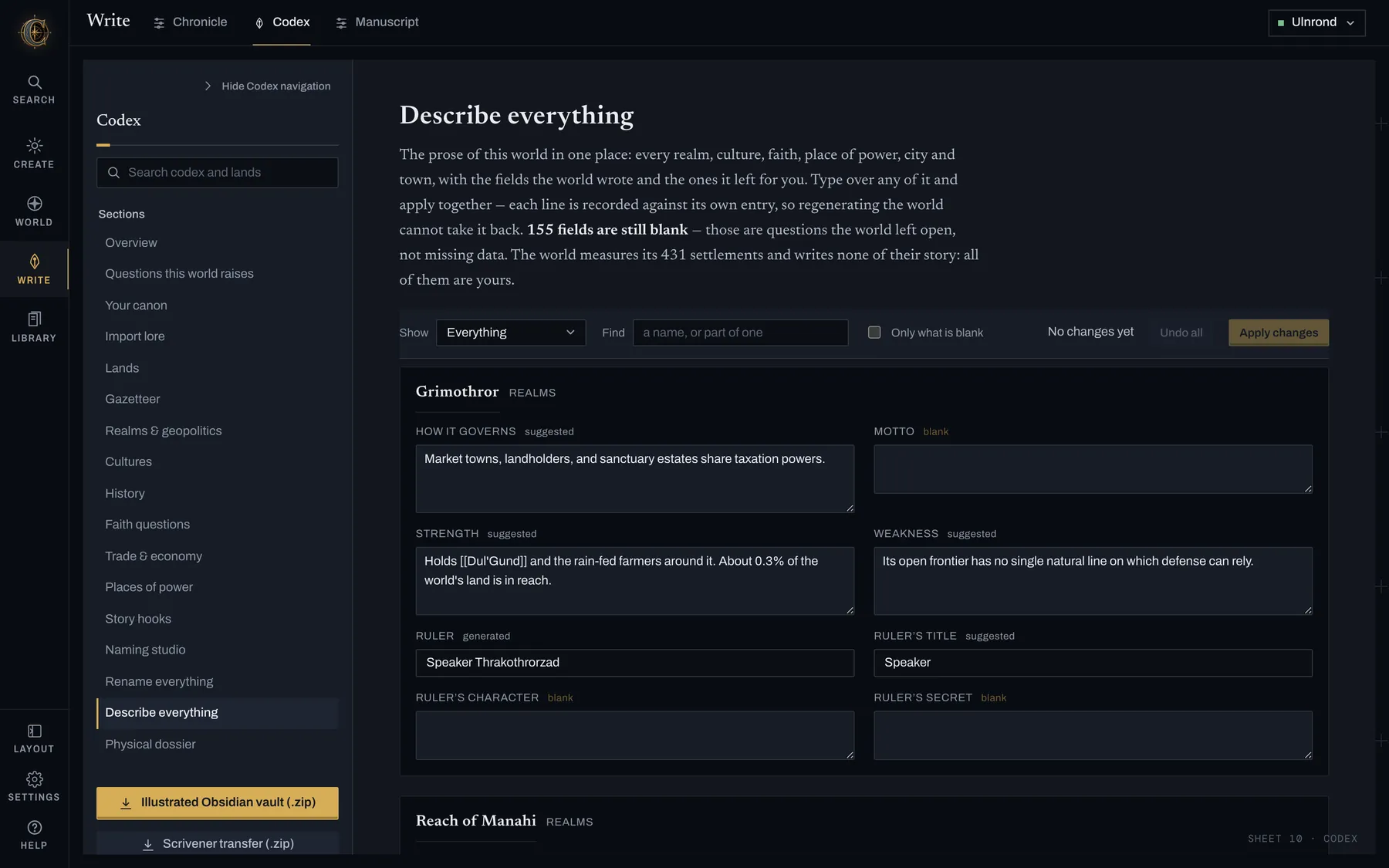
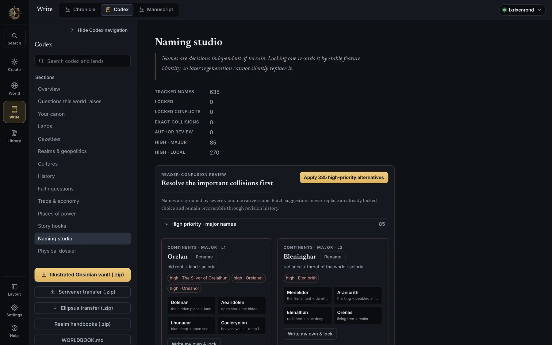
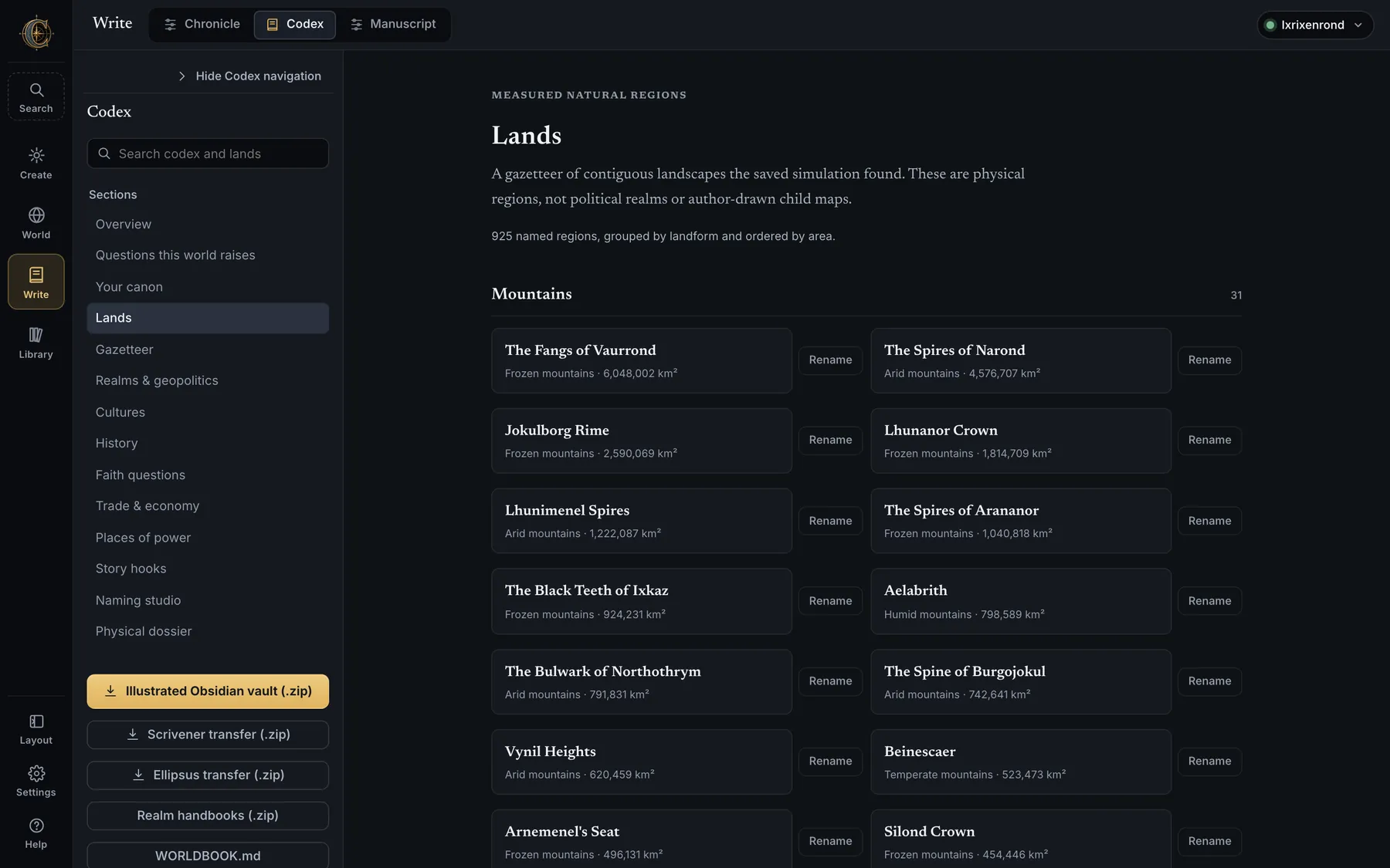
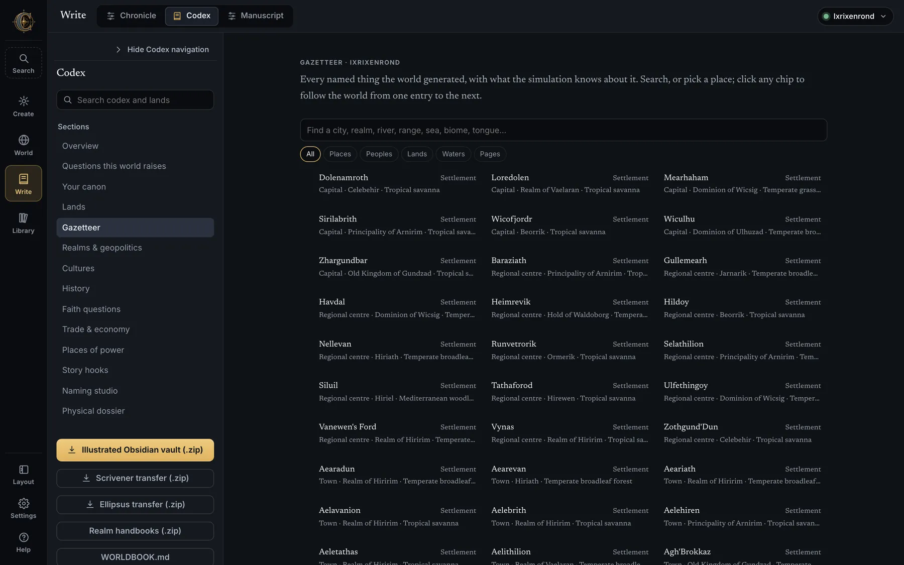
- Every
[[link]]in a Codex page opens that thing's dossier in place. - The vault is a real Obsidian vault: generated pages live under
codex/_generated/and rebuilding deletes only that folder, so anything you write elsewhere in it survives. - Story hooks, rulers and events you add are stored as overrides beside the terrain edits, which is why a re-simulation gives them back.
Write → Chronicle
Chronicle
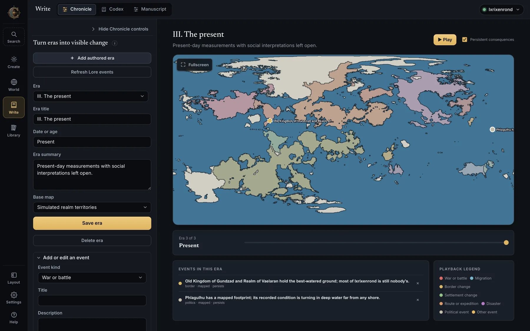
- Geological Deep Time and the human-scale Chronicle are kept separate. Initialize from Lore timeline imports the generated history as editable eras with stable links to their source entries; Add authored era starts from scratch; Refresh Lore events pulls in later lore edits.
- Eras carry a title, date or age, summary and a base map (relief, realm territories or others). Events are points, routes or areas — war or battle, migration, border change, settlement change, route or expedition, disaster, political and other — with persistent consequences that remain visible after the era in which they began.
- Play steps through the eras on the map; the legend explains the symbols; the scrubber names the era and its date.
- Chronicle maps, campaign maps, regional projects and lore maps share one annotation model, so a marker made in one is understood by the others.
Write → Manuscript
The world-aware word processor
A book is a folder of Markdown chapters inside the world's vault, so a chapter is at once an Obsidian page, part of the vault zip and a page in the Scrivener transfer. Manuscript writes never touch a world field.
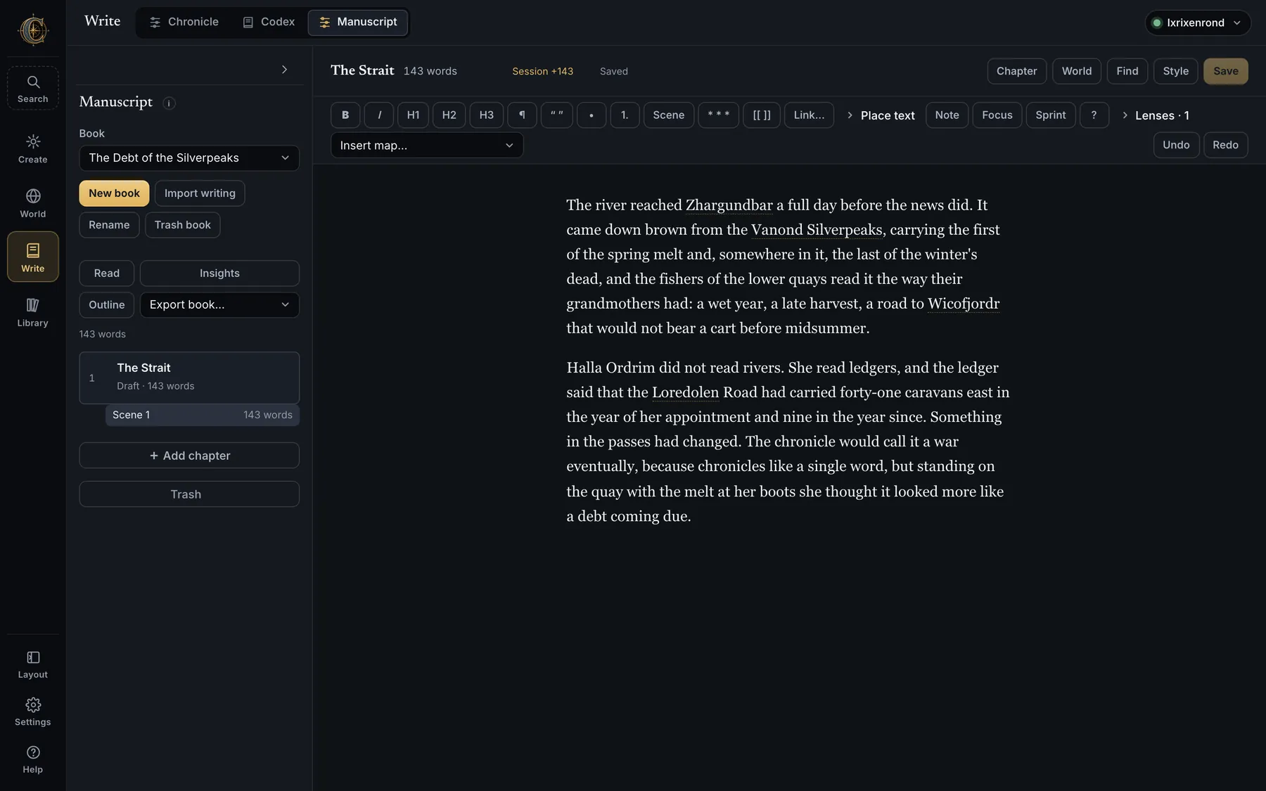
The formatting bar
One strip above the page since 0.9: the chapter menu, the marks used most often, then More for the rest, the lenses, the Book menu, the panel switch and Save.
Nine marks stay on the strip — bold, italic, heading, quotation marks, list, scene, link, undo and redo — because they are pressed as often as bold is, and a menu is a poor place for a mistake. Everything else from the old two-row toolbar moves into More, in the order it was written: H1, H3, ¶, numbered lists, the scene break, Link…, Place text, alignment, indents, the page break, the named styles (plain, first paragraph, verse, letter, epigraph), Note, Focus, Sprint, the shortcut sheet, the Lenses and Insert map…. Chapter holds rename, duplicate, move up and down, history and trash — which used to sit at the foot of a panel you had to open first. Book holds Read book, Outline, Insights and Export book…. The panel switch is Chapter, World, Find, Style.
- [[ ]] — type
[[and a name to link any vault page: realms, cities, cultures, places of power, natural regions, characters, your notes, other chapters. Link… separates visible text from a web address or a vault page. - Place text — align, indent, page breaks, and paragraph styles: plain, first paragraph, verse, letter, epigraph. They ride on inert comments in the Markdown, so Read, Word, HTML and EPUB honour them.
- Insert map… — any whole-world sheet, plate or city plan, with caption, width (quarter to full) and alignment; Edit map & caption on the figure.
- Lenses — tint the prose in place: sentence rhythm, dialogue, overused words, dialogue tags, world names. Local, never saved into the text.
- Note (⌘⌥N) — anchor a private note to selected words; notes never appear in Read or any export. Focus (⌘⇧F) dims everything but the paragraph you are in. Sprint counts down minutes against a word goal. ? (⌘/) lists every shortcut.
#,>,-and---convert as you type; the usual shortcuts apply; if the editor bundle ever fails to load, a plain text editor takes over.- The page itself, in 0.9 0.9 — a status bar under the page, a chapter that opens at its first line rather than wherever it was left, and a zoom that widens the page rather than only enlarging the letters. The Write column has its doors back, and a book brings its chapters with it.
- It stays quick in a long book 0.9 — saving used to re-read every chapter in the world to work out where the open one went, and measuring the open chapter ran on the typing thread. On a big imported book that blocked typing for 832 ms; it is now 0. Opening a chapter with unsaved edits went from 279 ms to 38, and a single autosave from 262 ms to 8. Two saves in the same second also keep their order now, which a history stamp built from two readings of the clock could not promise.
The Chapter panel and the binder
- Book — new, import, rename, trash, and a trash that can now be emptied; Read book, Outline, Insights and Export book… live in the strip's Book menu; the chapter list with status (Outline, Draft, Revising, Done), word counts and session progress; + Add chapter, duplicate, reorder; Trash with restore — never emptied automatically.
- Chapter cards — synopsis, point of view, setting, labels, word target and private notes. Daily goal per book, with a streak.
- Scenes — Scene or + Scene break starts one at the cursor; each has a title, point of view, place (searches the gazetteer) and when (day of year, hour, year in the world's own calendar). Move scenes with ▲ ▼ without losing history; the binder expands the open chapter into its scenes; Open beside shows another chapter read-only next to the one you are writing.
- The world card under a located, dated scene — the calendar day and month, the season as locals feel it (south of the equator is half a year out of step), the moon, sunrise and sunset from tilt and latitude, the saved weather for that day and the three after it, climate, biome, realm, culture and tongue with a few roots and meanings, and the distance, bearing and travel days from the previous scene, with a warning when fewer days pass than the journey needs. Every fact has Insert, Dossier, Map and Insert map (a 400 km relief crop as a figure).
- Versions — every save keeps the previous copy (the newest fifty); name one, compare it paragraph by paragraph with changed words marked, restore a paragraph or the whole chapter.
- Find — across every chapter and card, with match case, whole words and regular expressions; Find next (⌘G), Replace, Replace all in chapter, Replace in whole book… with history for every changed chapter.
The World panel
- The gazetteer beside the chapter: search any named thing, or click a link in the prose, and read its dossier without leaving the manuscript. It lists the world pages already mentioned in the chapter and inserts a selected page as a portable link at the caret; the vault page and realm handbook render beneath.
Insights and Checks
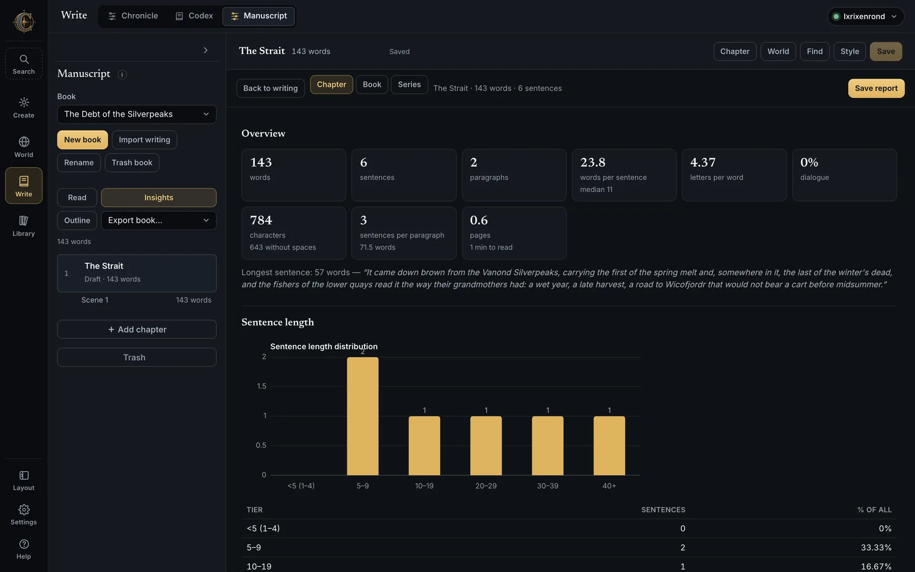
- Readability and passive voice 0.9 — scored per chapter, per book and per series. Reading ease and passive share join the overview tiles, and a Readability & voice table gives Flesch Reading Ease, Flesch–Kincaid grade, the automated readability index, words per sentence, syllables and letters per word, the share of words of three syllables or more, and the passive voice as sentences carrying one, total constructions and a rate per 1,000 words.
- Insights — chapter, book or series scope: words, characters, sentences, paragraphs, letters per word, words per sentence, pages at 250 words, reading time, the longest sentence; sentence-length tiers with a chart per chapter; most reused word families with per-1,000 rates and an ignore list; dialogue share, line length, longest run, tagged lines; dialogue tags ranked (only real speech verbs count); names from the gazetteer and other capitalised names (+ Name makes a character page); habits — repeated phrases, adverbs, filter words, sentence openers. Measured in the browser; Save report writes CSV, Markdown and JSON.
- Run checks — missing vault links, unavailable map references, word-target progress, and scene continuity against the world: a scene dated before the previous one, a journey that needs more days than pass between scenes, snow in a warm season, heat in a cold one, monsoon rain in a dry one. Suggestions, never blocks.
Import writing
- PDF, Word (.docx), RTF, OPML, Markdown and plain text. Chapters are detected by their headings — chapter numbers, viewpoint titles, prologue, epilogue, front matter — and created in order, with the original upload preserved inside the world. PDFs lose their running headers and page numbers, wrapped lines rejoin into paragraphs across page breaks with hyphens mended, and short capitalised lines become headings; scanned PDFs need OCR first.
- Italics and bold survive; footnotes come through and leave again as real footnotes in Word, HTML and EPUB; an imported Word file's tracked changes deliver the book as it reads.
Style, Read, Print, Export
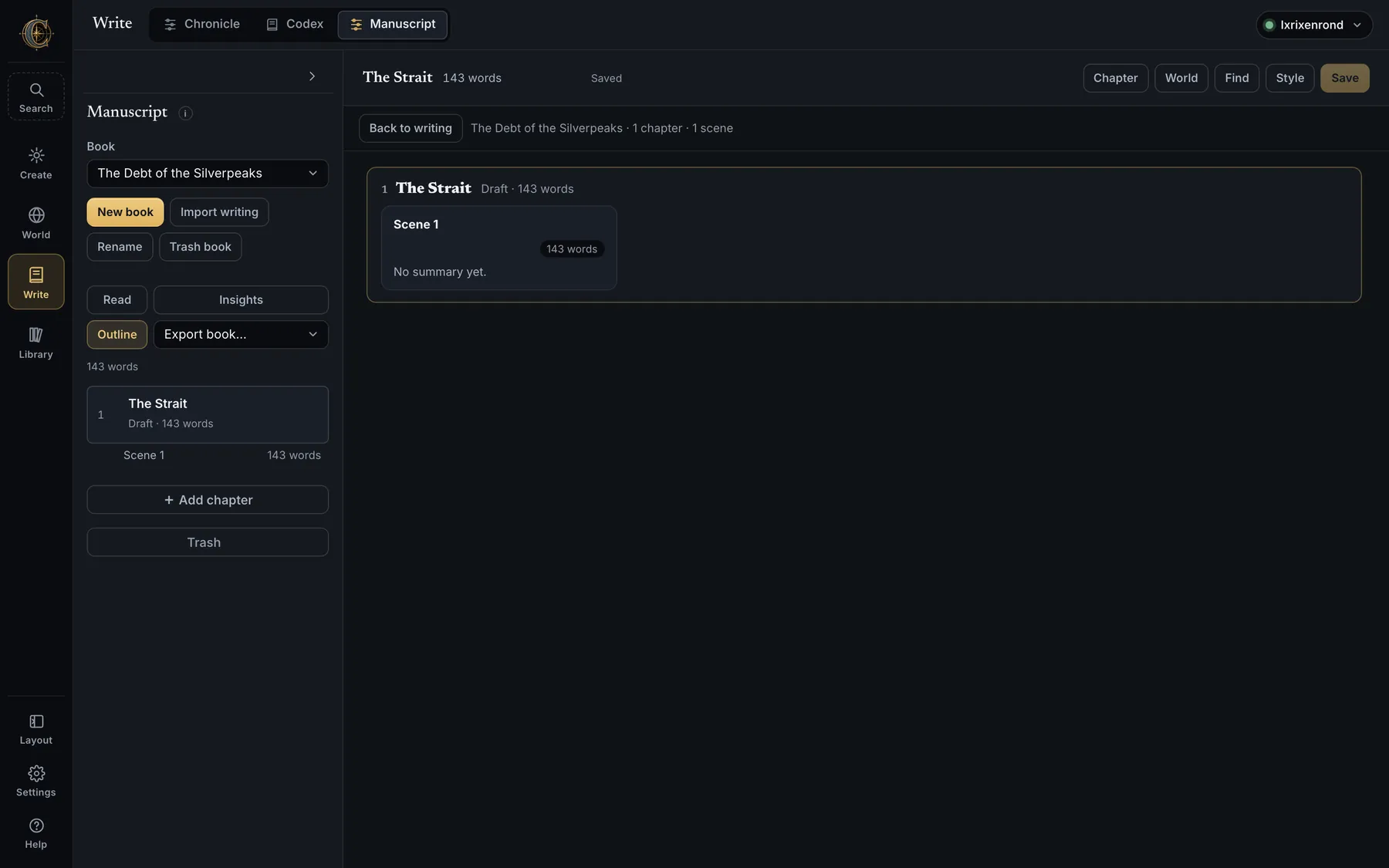
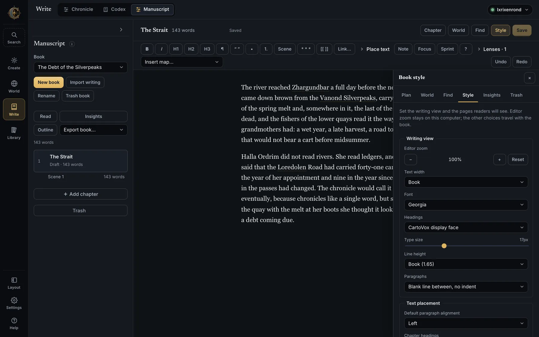
- Style — editor zoom (local), then the book: author and subtitle, font (Georgia, Palatino, Baskerville, Times, Charter, Inter, Courier, the CartoVox display face), heading face, size, line height, text width, paragraph style, alignment, margins, page size (US Letter, A4, Trade 6 × 9), running header and footer presets or custom text with
{title},{author},{chapter}and{page}, first page number, chapter numbering. - Cover design — include or omit a cover, any map, plate or city plan as its image, fit, shading, text colour and background, title size, alignment and placement. World card in Library can show this book's cover, or its cover map alone, as the world's face.
- Read flows the whole book with its cover; Print / PDF paginates at the chosen size and margins with running headers and page numbers where the browser supports them.
- Export book… — Word with headers, page numbers, embedded maps at page resolution, clickable links and real footnotes; Markdown with relative images; a Scrivener package; a self-contained web page; an EPUB 3 e-book. All under
renders/manuscript/. - Autosave after a pause, on blur and on ⌘S; a save based on a stale copy is refused with both texts shown; unsaved text is mirrored in the browser and offered back; chapter changes and exports wait for the latest writing to save.
Library
The Library
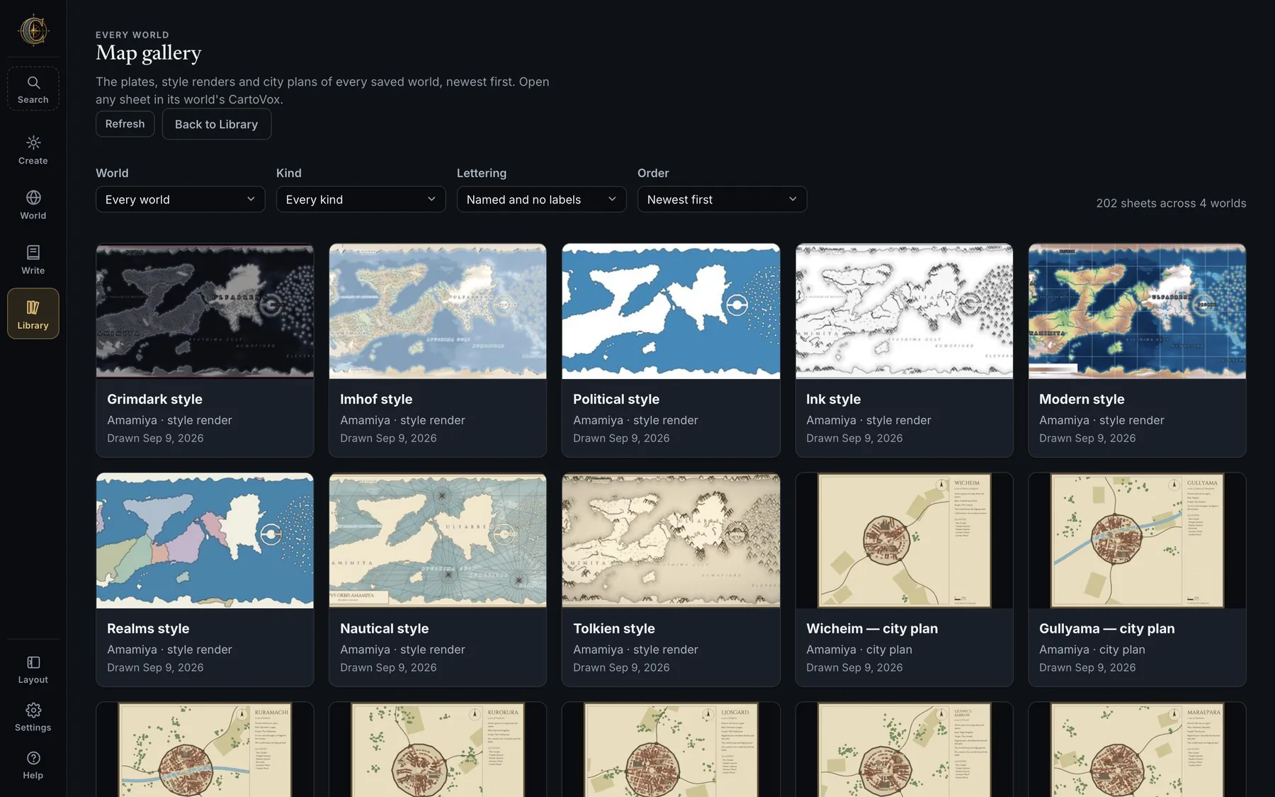
- World cards — name, seed, continent count, land area, revision, status, a favourite star, and the face you chose (relief, a book cover, or a cover map). Open, trash, and the revision badge that refreshes as you work.
- Trash — completed worlds are recoverable for 30 days, cancelled or failed ones for seven; a 5 GB soft limit warns and never silently deletes; Restore prefers the original identity and makes a fresh one if it has been reused. Deleting moves to
worlds/.trash/, never straight to oblivion. - Map gallery — every illustrated plate, style render and city plan from every world, on one wall.
- Build the example world 0.9 — the offer on an empty Library, and on the Create screen. Eldrebrenn lands here like any other project; it disappears from the Library once you have a world of your own, and a second one is never built beside the first. What it costs, at first launch.
- Import project backup — a
.cartovoxfile comes in under a safe new identity with its revisions, lore, campaigns, Chronicle and regional state. - Resume tracing — beside the map picker: reopen a coastline tracing session after a restart, or load a portable draft.
- In-progress and failed generations have their own cards, cannot be opened as finished worlds, and can be recovered or removed.
- Search spans every saved world: names, realms, settlements, natural regions, lore, eras, campaigns, aquifers.
App settings
Settings — ⌘,
Seven sections that change how CartoVox looks and behaves on this computer, and nothing else. Changes apply immediately; there is no Save button that could disagree with the screen.
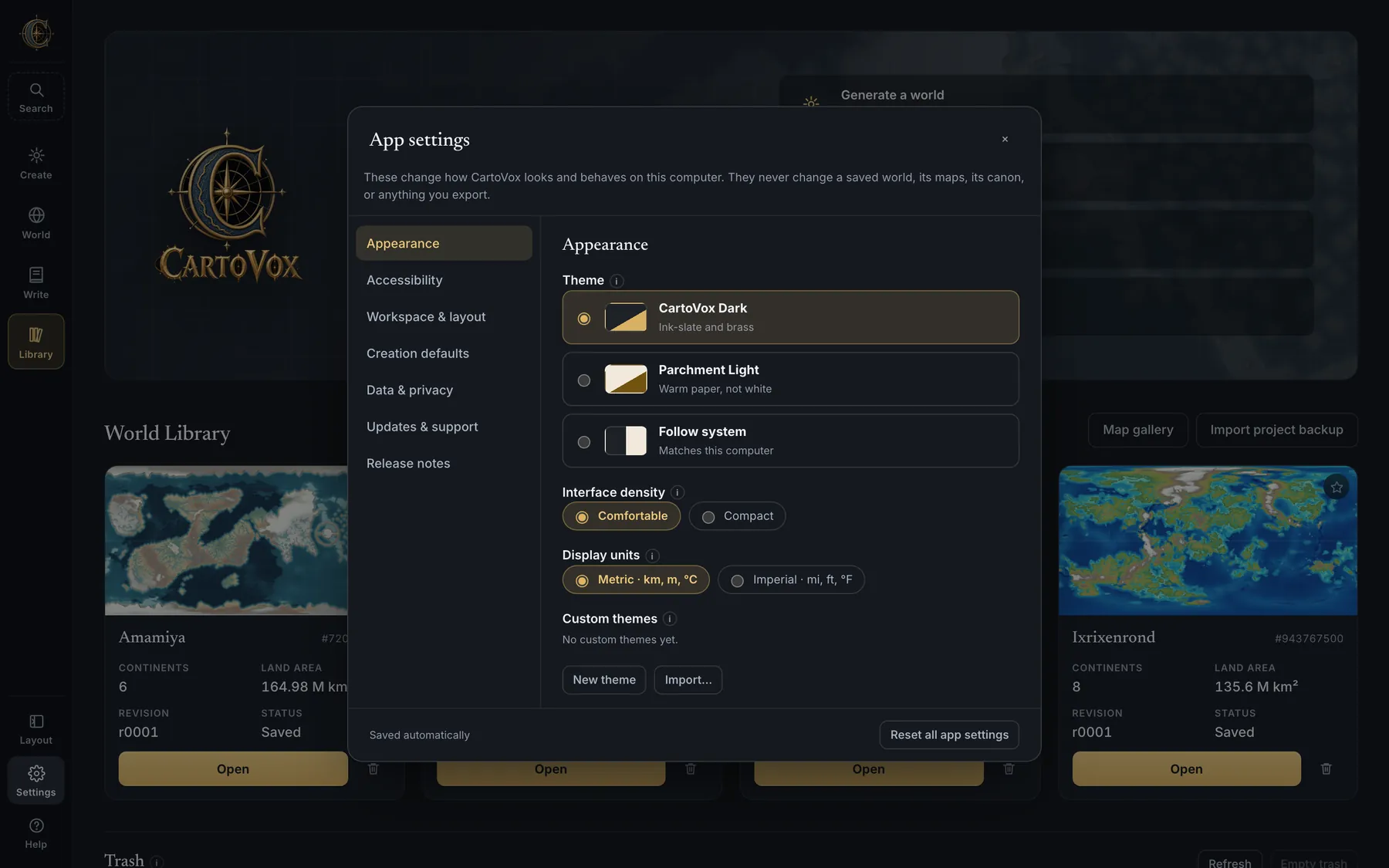
- Appearance — CartoVox Dark, Parchment Light (warm paper, not a white inversion) or Follow system; Interface density, Comfortable or Compact; Display units, metric or imperial for the interface only, with saved data, Advanced settings, map artwork and exports staying metric. Custom themes: create, duplicate, rename, export and import small JSON files of named colours with an in-app picker; up to twelve; contrast is checked before a theme can be applied and a failing pair is named with its ratio. Themes change chrome and never output — a world's 121 files hash identically across every theme.
- Explanations 0.9 — most controls carry a sentence saying what they do, and those sentences now stand where they were written for your first few sessions rather than hiding behind a small “i” that only appears on hover, which is invisible on a first pass and unreachable on a touch screen. After that they fold away. This preference overrides it in either direction — always show, always fold, or let CartoVox decide — and changing it moves the page you are looking at rather than the next launch. A button you cannot press now tells you why rather than restating what it would have done, and that answer arrives even when the pointer is already resting on it.
- Accessibility — text size 100%, 110% or 125%; reduced motion (a system request always wins); every text colour clears WCAG AA.
- Workspace & layout — open at the Library, Create or wherever you were; remember the section within each destination; open or reset the Layout customiser. How much to show at once 0.9 — Everything or Essentials, where Essentials keeps the surfaces a world is read from and hides the specialist ones (the climate laboratories, the planetary panels, the analytical maps). It changes nothing about how a world is simulated or saved: every map is still made, and every hidden thing says how many it is holding and gives them back in one click.
- Creation defaults — the same record Create edits: First build (Sketch, Quick or Full), atlas plates, atlas lettering. Defaults for new runs only; they never alter a world you have already built, its saved configuration or anything you exported from it.
- Data & privacy — Storage and display cache measures bytes by world and category (fields and saved maps, author content, plates, the rebuildable display cache, exports and renders, revisions, backups, trash); only the display cache can be removed, after a preview lists every file; a retention preference bounds it by size and age. Move the data folder. Local diagnostics with privacy-aware redaction; Copy app info copies name, version, build and platform and never paths, keys or world names.
- Updates & support 0.9 — CartoVox no longer checks for updates. The daily poll, the installer download it fed and the notification banner are gone, and so is the certificate bundle the poll needed; new builds are announced on the Discord server, which is also where the installer is shared, and this section carries one button that opens it. There is no preference to turn off, because there is no request to stop. About, the folder shortcuts, diagnostics, and the Licence and third-party notices, offline.
- Release notes — the full history inside the app, starting at the running version, with Older / Newer navigation, offline.
- Reset all app settings clears preferences and layout — never worlds, lore, revisions, drafts, backups, recipes or an unsaved sculpt.
Reference
Keyboard
Anywhere
| ⌘K / Ctrl K | The command palette — names and actions |
| ⌘, / Ctrl , | App settings |
| ? | The key sheet |
| Esc | Close panels and tips |
| Arrow keys in a tab list | Move between workspace and panel tabs |
On the map, with a world open and nothing being typed
| M L C R | Measure · Landmarks and routes · Explain climate here · Regional lens |
| S N A | Sculpt terrain · Render Studio · Planet Advisor |
| K Y T E | Climate Lab · Weather year · Tectonics audit · Erosion Lab |
| B W X P F | Map library · World details panel · Export menu · Planet globe · Focus map |
| I V H D G | Minimap · Split view · Time strip · HD region · Map grid |
| = - 0 | Zoom in · zoom out · actual size, and the world turned back to its own centre |
In the manuscript
| ⌘S | Save now (it autosaves anyway) |
| ⌘B ⌘I | Bold, italic |
| ⌘F / ⌘G | Find in book / find next in this chapter |
| ⌘⇧F | Focus mode |
| ⌘⌥N | A note on the selected words |
| ⌘/ | The full sheet for the editor |
[[ | Link a vault page as you type |
| ⌘-click a world name | Open that thing's dossier beside the chapter |
| Tab / ⇧Tab | Indent or outdent a list item |
On the Render Studio canvas
| ⌘Z / ⌘⇧Z | Undo · redo (one history covers artwork, drawing, lettering, appearance and output settings) |
| Arrows · ⇧+arrows | Nudge the selection, and nudge it further |
| Delete | Remove the selection |
| Enter / Esc | Finish a drawing · cancel it |
| ⇧ while rotating | Snap to 15° |
On disk
What a world writes to disk
Your work is a folder in an open, documented layout — not an account. Everything below lives under the world's own directory in the CartoVox data folder.
| File or folder | What it is |
|---|---|
01_relief.png … 20_landmarks_routes.png | The numbered map sheets: relief, biomes, globes, tectonics, biome key, temperature, precipitation, seasonal range, aridity, drainage, currents, civilisation, seasonal panels, winds per season, tidal range, soils, glacial legacy, resources, landmarks and routes |
plates/ · styles/ · city_plans/ | Illustrated sheets (labelled and unlabelled), the style renders, one plan per major settlement |
world_data.npz | Every field as a NumPy array: elevation, biome IDs, precipitation, soils, currents, hydrology and more |
world_summary.json · WORLDBOOK.md | All measurements as structured data, and the measured dossier |
hydrology_graph.json | Depression hierarchy, basins, lake water balances and the directed river reach graph |
simulation_health.json | Scored, evidence-backed checks with locations and revision-to-revision changes |
world_config.json · world recipe | The full resolved configuration (339 fields) and the short list you actually chose |
tectonic_provenance.json · orbital_forcing.json · terrain_import.json · lineage.json | Which tectonic model ran and what it measured; the exact orbit and tides; an import's checksum and mapping; where a reseeded world came from |
name_registry.json · name_choices.json · lore_overrides.json · overrides.json | Every name with its identity and audit; accepted names kept apart from terrain; your lore edits; your terrain edits |
codex/ | The Obsidian vault: _generated/ pages, novels/ with one Markdown file per chapter and manuscript.json, characters/, the series bible |
handbooks/ · revisions/r####/ · snapshots/ | Realm handbooks; the authoritative revision history; measurement snapshots for continuity diffing |
projections/ · previews/ · @2x–@4x caches | Projection sources and rebuildable display caches — left out of backups, trimmed under a 512 MiB per-world budget, rebuilt on demand |
renders/manuscript/ · exports/ | Book exports, insights reports, figure crops; STL, OBJ, GeoJSON, scientific bundles |
weather_sheet.json · campaign, Chronicle and regional project files | Authored state, written atomically in UTF-8 and included in revisions |
project_backup.cartovox | The whole project, round-trippable through the Library |
Coastline tracing drafts live in tracing-drafts/ under the data folder, custom themes and recipes in the browser or installation's storage, and the trash under worlds/.trash/. The data folder can be relocated from Settings, and CARTOVOX_DATA_DIR overrides it.
Reference
Questions testers keep asking
The gold button is greyed out.
A blocked control says why it is blocked rather than what it would have done — hover it, or reach it by keyboard. The usual reasons are that no brief has been written yet, or that a map is attached and still waiting for its coastline check. In the second case CartoVox offers to remove the map and generate from your settings alone; keeping it leaves you on Create with Review map one keystroke away.
I set up a new world and it rebuilt my imported map again.
An imported or drawn map stays attached to the Create sheet after the world it was brought in for is finished. The Foundation map row names it beside the button that uses it; Remove map is in that row.
My imported world came out covered in ice, or all mountains.
Heights were being scaled so that far too much of the world sat above 2,000 m; that was fixed in 0.9, and a round-trip of a saved world's own elevation now lands where it started. If it still happens, the questions in the map review — how high the peaks reach, how wet and warm the world is — are the levers, and they are ordinary Advanced settings.
The rivers on my map became sea inlets.
That was the old behaviour: the coastline reader saw blue, called it water, and a drawn river became a sea-level fjord slicing the continent. Rivers and lakes are now told apart by width, and you choose whose rivers the world gets. See importing a map.
My continent is much smaller on the planet than the number suggested.
An imported sheet is usually a continent adrift in its author's painted sea, and the old width control resized both. Use the share-of-planet control and the ocean trim together: on a test sheet that is 85% water, trimming took the same coastline from 11.5% of the planet to 34.7% without a pixel of the coast moving.
My continent is cut in half by the edge of the map.
World › Tools › Turn world, then drag sideways. 1:1 returns the world to its own centre.
The tool is off until you ask for it, because a drag that quietly reprojected every marker and route made ordinary
panning feel like the map was fighting back.
Where are my illustrated plates?
World › Atlas. If you deferred them or stopped the build early, Render remaining plates
draws them from saved data without re-simulating anything.
How do I print a map, or the whole atlas?
Any view downloads as a PNG from World › Export. The whole illustrated set binds as one
print-ready PDF — title page, contents, a page per plate at a real paper size, and a colophon that carries the
seed so the world can be rebuilt from the book. Every plate is embedded at its own resolution and the export
reports the dots per inch page by page rather than asserting a number.
Why is the map a rectangle?
The world is simulated on a sphere and drawn equirectangular: it wraps east–west and the poles are real poles. Plates rotate about Euler poles, winds deflect about a rotation axis, and ocean gyres need enclosed basins with a western boundary — a flat disc has none of those, so on a disc none of the geography could be derived. Use the globe card, the four-globe sheet, or an equal-area projection to check that it reads as a planet.
Something looks wrong near the pole.
A long thin landmass near a pole is usually the projection, not the terrain. Measure it on the sphere with Measure, or look at it on the globe.
How long will a build take, and how much disk?
The COST row on Create answers for your settings and learns from completed builds of the same shape on your own machine. As orientation: a Sketch with an illustrated atlas measured 30.5 seconds on a fast Apple Silicon Mac, and the example world 83.9 seconds and 179 MB. A Full build with every publication plate is the long one — about eight minutes on a high-end Mac and about thirteen on a high-end Windows machine, with the hand-drawn plates most of that. On disk: 45–100 MiB for a Quick world, 180–360 MiB for a Full one without plates, and 337–883 MiB with every publication plate. The preflight keeps a 1 GiB reserve and warns above 500 MiB.
Can I stop a build, or use the app while one runs?
Yes to both. The generation dock keeps a long build running while you work elsewhere and survives a reload. Stop after this plate finishes the current image cleanly and stores the rest; an interrupted run is detected and can be resumed from its stage checkpoint or removed.
Nothing has any descriptions. Is that a bug?
No. The generator leaves prose blank rather than inventing it, and Write › Codex › Describe everything
says how many fields are open and can show you only those. They are questions left for you, not missing data.
How do I change a name everywhere it appears?
Write › Codex › Rename everything for the whole world on one sheet, or select the feature on the
map and use Rename everywhere. Canonical names propagate through maps, dossiers, lore, routes, tongues,
exports and later revisions.
Can I move a city, or will the generator move it back?
Move it with Sculpt › Select feature › Choose new location, or place a new one on land with at
least 20% saved suitability. Cities and borders you draw hold their positions against the world's own.
I changed the terrain and everything else stayed the same.
Terrain edits are pending until Apply & re-simulate, which rebuilds climate, rivers, biomes, settlements, routes, names, lore and maps. Build comparison draft shows you exactly what moved first, without writing to the original world.
I rebuilt a Quick world at full resolution and the coastline changed.
Expected, and why the rebuild is a separate project. Broad geography stays familiar, but finer coastlines, rivers, climate boundaries, settlements, names and generated lore can all move on a finer grid. The world you chose stays exactly as it was.
Where did my world go?
Library › Trash: 30 days for a saved world, 7 for a cancelled or incomplete generation, with the
recoverable size shown. Nothing is removed early to save space.
I can't find a panel I used yesterday.
Two likely causes. Settings › Workspace & layout › How much to show at once may be set to
Essentials, which hides the specialist surfaces; every hidden thing says how many it is holding and gives
them back in one click. Or a region is hidden in Layout — Show everything restores it.
The little explanations under the controls disappeared.
They fold away after your first few sessions, since by then they are in the way.
Settings › Appearance › Explanations overrides it in either direction, and the change moves the page
you are looking at rather than the next launch.
How do I move my worlds to another computer?
World › Export › Complete project backup (.cartovox) per world, restored with
Library › Import project backup. To move the whole library on one machine, use
Settings › Data & privacy › Change save folder — it copies existing worlds and keeps the old
files as a safety copy, and never deletes the former library automatically.
Does CartoVox send anything anywhere?
No. There is no account, no telemetry and no update check; the only address it opens is the loopback dashboard it started itself. The optional local diagnostics journal is off by default and stays in your browser profile.
Can I sell what I make with it?
Yes. You may publish and sell the worlds, maps and writing you create; you may not copy, share, resell or
redistribute the application itself. The licence is at Settings › Updates & support › Licence and
on this site.
How do I report a bug?
Settings › Updates & support › Report a bug on Discord, or World › Tools › Report
for a specific map. A useful report includes the seed, preset, tier, any Advanced settings overrides, and the exact
simulation-health finding. Copy app info copies name, version, build mode and platform — never paths, keys,
world names or anything you have written. Create diagnostics builds an archive of build details and redacted
logs, which you can inspect before sharing.
Read before you lean on a number
Known limits
CartoVox documents what it approximates, at length, inside the app. The short version:
- Desktop is the authoring target. The mobile layout reviews a world; it does not build one.
- Drawing density is not simulation detail. 2×–4× and Render Studio interpolate the same saved cells; only a full-resolution rebuild adds simulated cells, and it does so in a separate project.
- The default tectonics is one kinematic snapshot, correlated around generated ridge systems. Deep Time transports crust for hundreds of millions of years but does not solve mantle convection.
- Four seasons, not twelve months; Köppen thresholds are applied per season. Orbital cycles are forcing, not an N-body integration. Tides are climatological, not a tide table.
- No thermohaline circulation — currents are wind-driven only. Erosion runs two passes, so valleys look young. Hydrology is regional: a directed reach graph with lake nodes and morphology classes, not fluid dynamics.
- Soils are regional pedology; resources are prospects, not proven reserves; glacial history is reconstructed, not integrated through every ice age.
- Land needs crust to stand on. Asking for more land than there is continental crust drains the sea until seafloor is exposed, and the run says so.
- Atlas labels are placed, not typeset: a name that will not fit at any rung of its shrink ladder is dropped and reported rather than broken over two lines. Stamps are procedural; mountains read as massifs rather than chains; sub-cell coastline crinkle is a deliberate, switchable invention.
- A long thin landmass near the pole is usually the projection, not the terrain — measure it on the sphere.
- Reproducibility is checked two ways: the same seed in two processes must give byte-identical plates, and a seed must render identically whether or not another world was drawn first.
- Publication cost depends on the selected outputs. A Full build with every plate currently takes about 8 minutes on a high-end Apple Silicon Mac and about 13 minutes on a high-end Windows machine; the preflight measures your own machine as it goes.
Version-by-version model changes are recorded in the release notes, each versioned in the world's configuration so a saved world always states which model produced it.