

A desktop world simulator for authors and game masters
Describe the world.
CartoVox finds it.
Write a brief — three continents around a contested sea — and CartoVox searches reproducible seeds for it, simulates the winner from plate tectonics upward, and hands you an illustrated atlas, a naming system, a history, and a place to write the book.
- macOS · Windows · Linux
- No account
- No cloud
- No generative AI
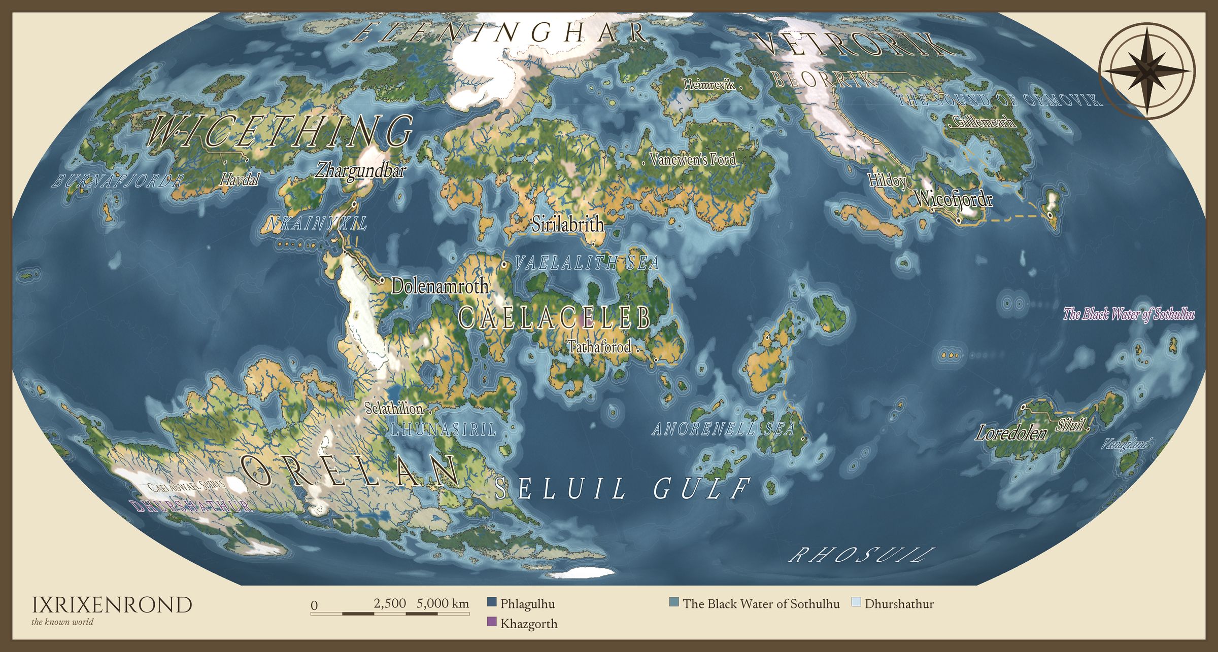
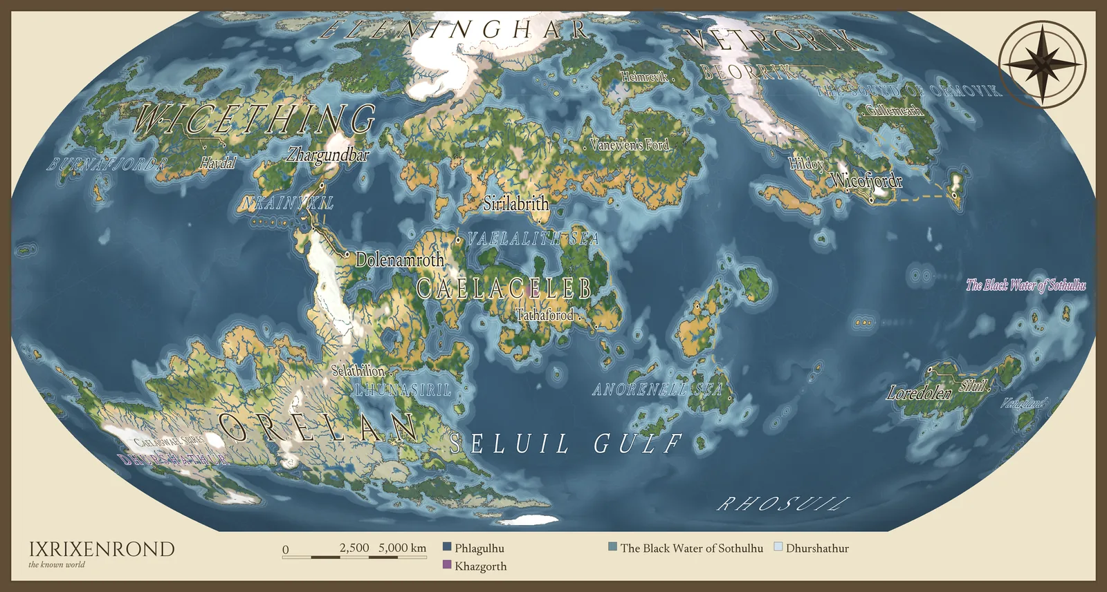
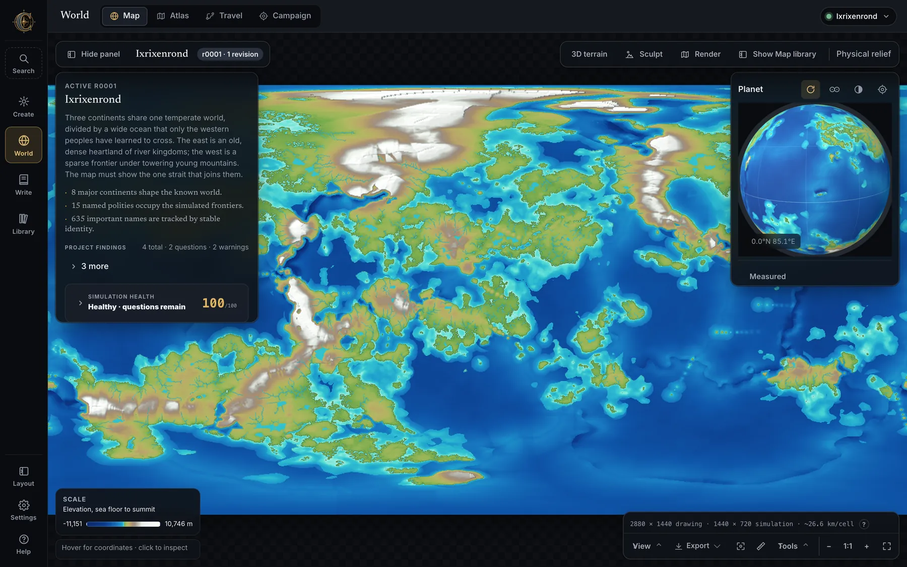
Ixrixenrond — a world plate CartoVox drew from one seed and one brief. 4800 pixels wide, nothing painted by hand.
01 — The brief
You write the world you want.
CartoVox goes looking for it.
Most generators hand you the first random landmass and wish you luck. CartoVox reads a written brief, turns the requirements it can measure into checks, and scores reproducible seeds against them. If you ask for three continents and a candidate has two, it says two — it never quietly returns the nearest thing.
Three continents share one temperate world, divided by a wide ocean that only the western peoples have learned to cross. The east is an old, dense heartland of river kingdoms; the west is a sparse frontier under towering young mountains. The map must show the one strait that joins them.
- “Three continents” reads as exactly 3 major continents
- “dense heartland” reads as a dense old world
- “river kingdoms” reads as a few dominant rivers
- “frontier” reads as a dangerous frontier
The reading never edits your brief. Each cue offers an explicit Apply; the rest stays for you to decide.
Try the idea
A toy search, drawn in your browser: six seeds, one hard constraint — exactly three continents.
Press Search seeds. Matches are marked; misses state the actual count.
This is a sketch of the workflow, not the simulator. The real search scores your whole brief against spherical worlds with moving plates — and the candidates below came from it.
One brief, four answers
The same sentence, searched four times.
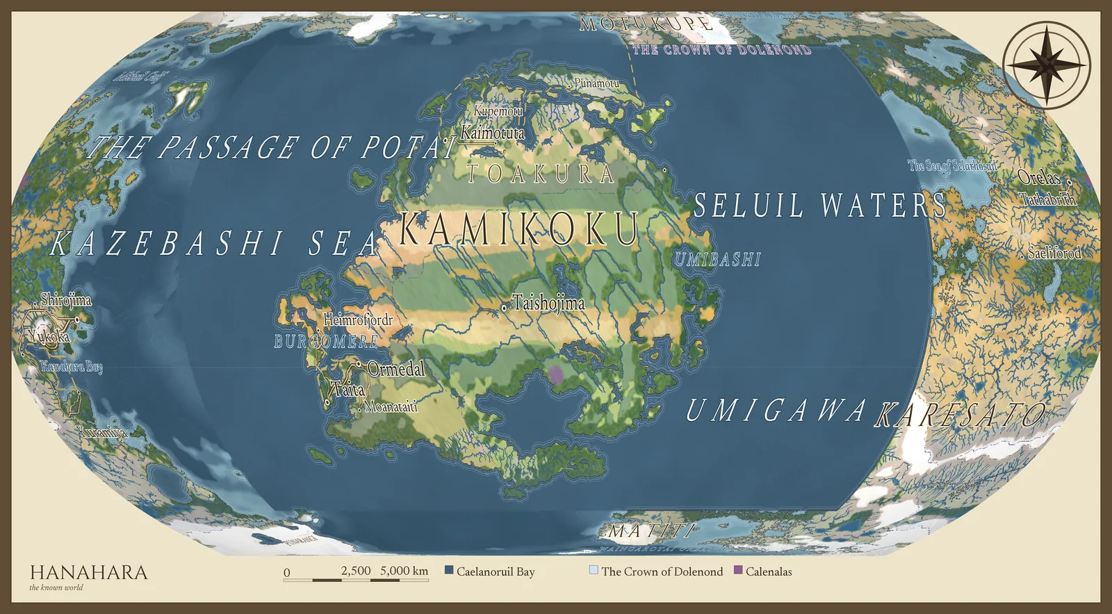
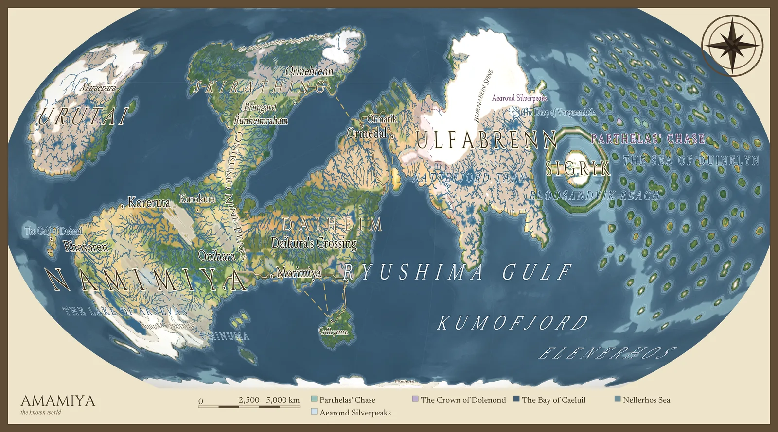
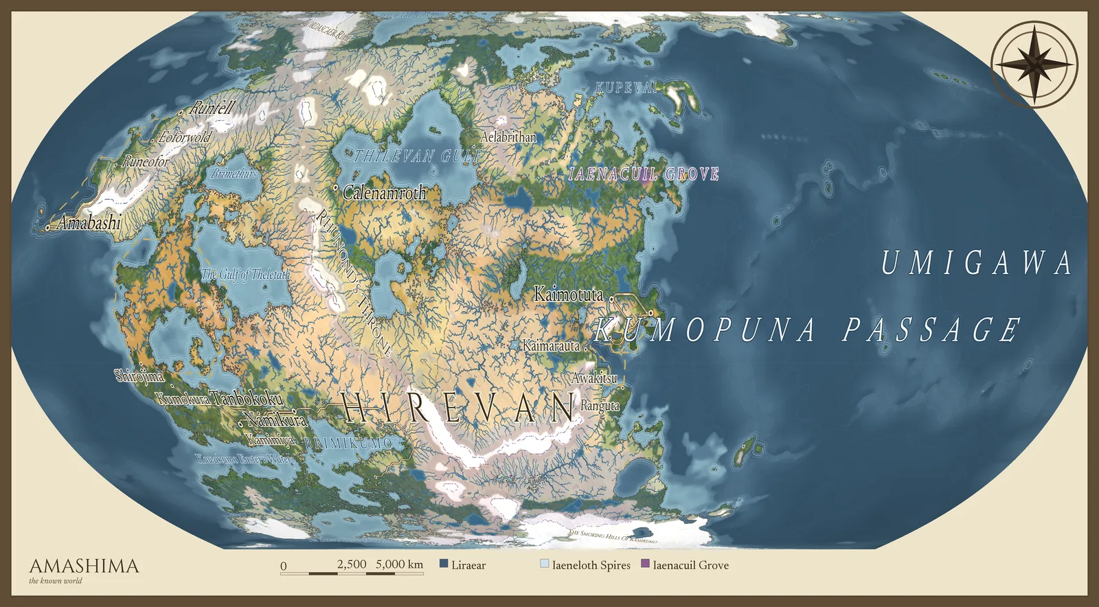
Every plate below was generated from the brief above with a different seed. Same settings, same simulation, four honestly different planets — each reported against what the brief asked for, not dressed up as a match.
02 — The causal chain
Every number in the dossier is measured, not invented.
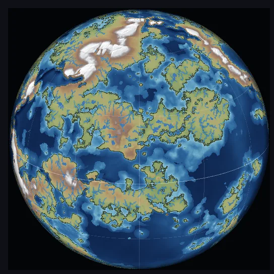
One seed and one configuration produce a spherical planet with moving plates and a real geological history. Everything downstream follows from the link before it — and you can click any cell of the map and ask why.
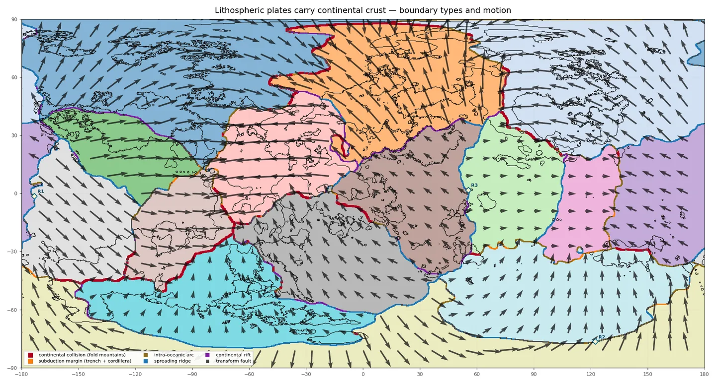
Planet first, map second: the simulation runs on a sphere and is shown flat. East and west wrap; the poles are real poles.
03 — One desk, three rooms
Create the world. Explore it. Then write in it.
CartoVox is a single desktop application with three workspaces that share one record. Rename a settlement once and it changes in the atlas, the dossier, the routes, the codex and every export — because there is only one place it lives.
Four ways in, not four presets.
- Generate — write the brief, preview seeds, shortlist, vary, then commit to a full simulation.
- Import — bring a PNG, JPEG, TIFF or heightfield; CartoVox reads the coastline and simulates everything downstream.
- Draw — paint continents on a wrapping ocean, carve rivers, write labels; the world is simulated on your sketch.
- Deep time — assemble and break continents across hundreds of millions of years, then choose the era to live in.
Before it starts, the preflight tells you the expected disk and time for your settings. Nothing is hidden in a spinner.
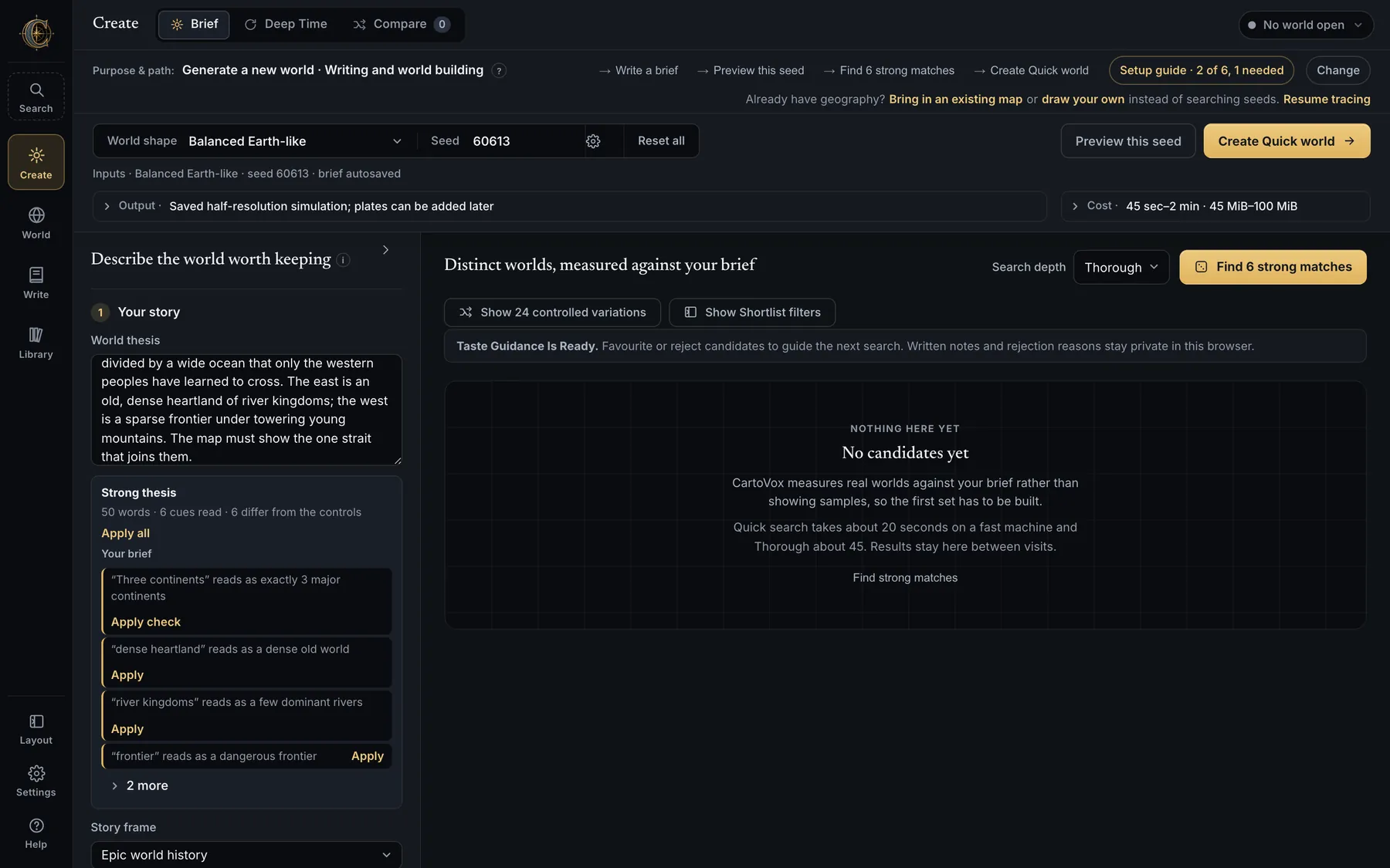
Forty-nine views. One geography.
- Map — relief, plates, climate, currents, soils, biomes, resources, settlement; click a cell and it explains itself.
- Atlas — publication plates at up to 4800 px, labelled or not, with six cartographer reading desks.
- Travel — route walkers, riders, caravans and ships between named places and read the cost of the road.
- Campaign — spoiler-controlled player layers, saved regions and journeys, a presentation mode for the table.
A Planet card shows the live globe; a Regional Lens turns any window into its own child map with inherited names.
The book lives in the same vault as the map.
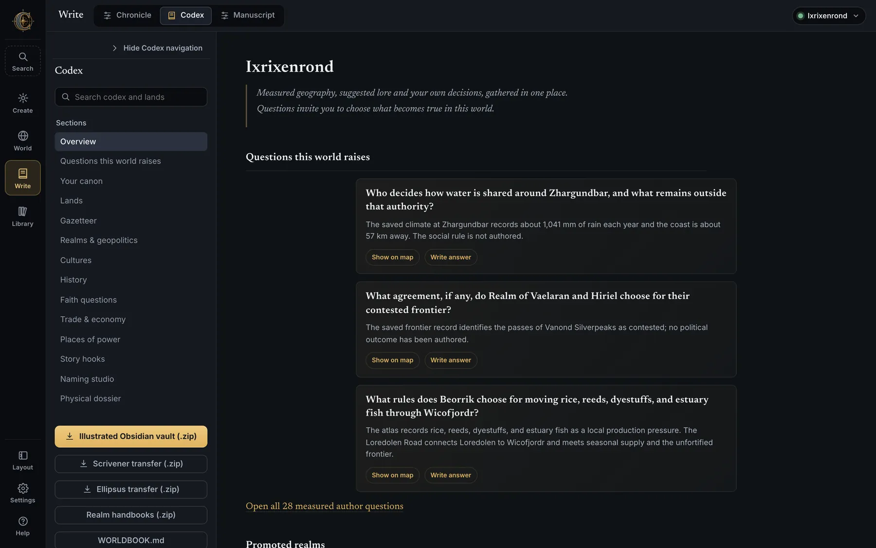
- Codex — realms, cultures, trade, faith, places of power, and the measured questions the world raises.
- Chronicle — a human-scale timeline you can author and play forward on the map, with consequences that persist.
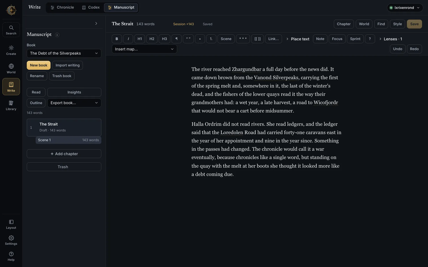
- Manuscript — a word processor inside the world:
[[links to any place, scenes on the map, checks that catch a distance or a date drifting. - Exports — Word, Markdown, Scrivener, EPUB, HTML; an Obsidian vault; realm handbooks; the whole worldbook.
Generated lore is a proposal. Social history, politics and story hooks stay non-canon until you accept or rewrite them.
04 — The illustrated atlas
Seven traditions. Seven cartographers. One world.
The same geography, drawn as seven traditions rather than seven filters: ink on parchment with profile ranges, a working nautical chart with rhumb webs and soundings, a modern hypsometric atlas, a clean coastline base, a realm map grown by travel cost, a sparse printable sheet — and a grimdark sheet where red is spent only on the blighted ground.
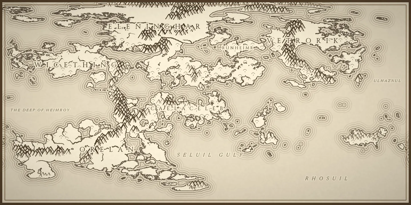
With names, or without.
Every illustrated sheet can be lettered, left as a painting base for your own artwork, or both — from the same source, without re-running the simulation. Rename a city later and redraw only the lettering.
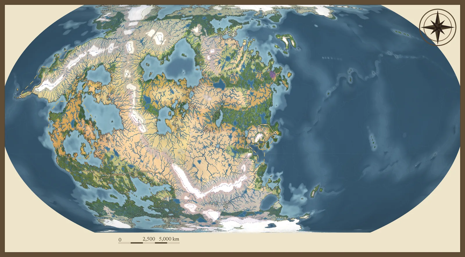
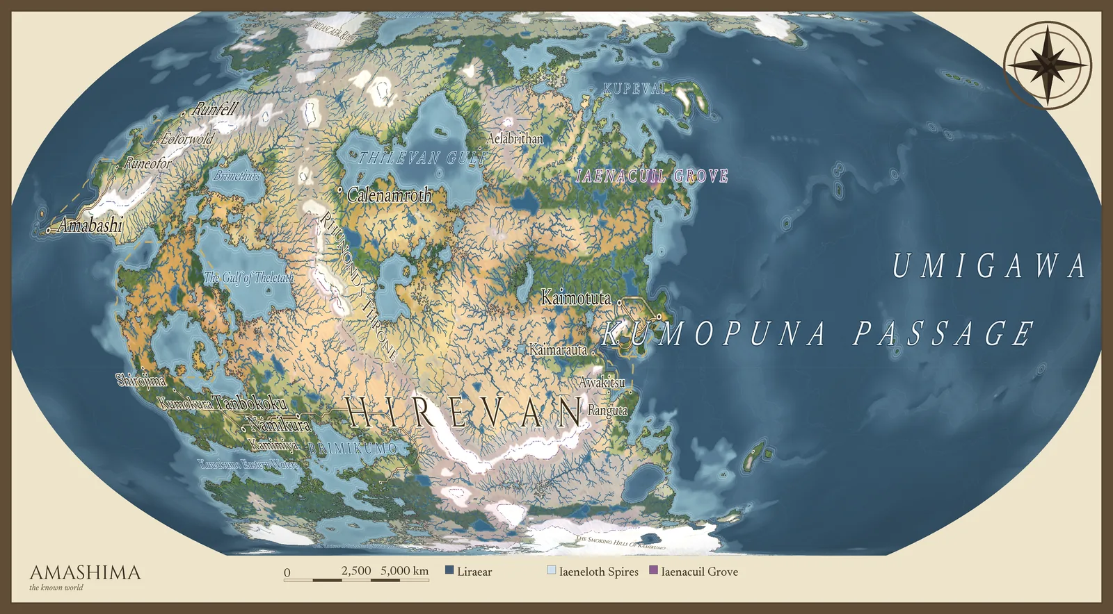
Then zoom in, and it is still a map.
Any region becomes its own plate with inherited names, local pins and hand-drawn routes. Original hand-drawn mountains, hills, volcanoes, trees, reeds, dunes and reef shallows are placed from the saved terrain, canopy and tectonics — the illustration never changes the geography underneath it.
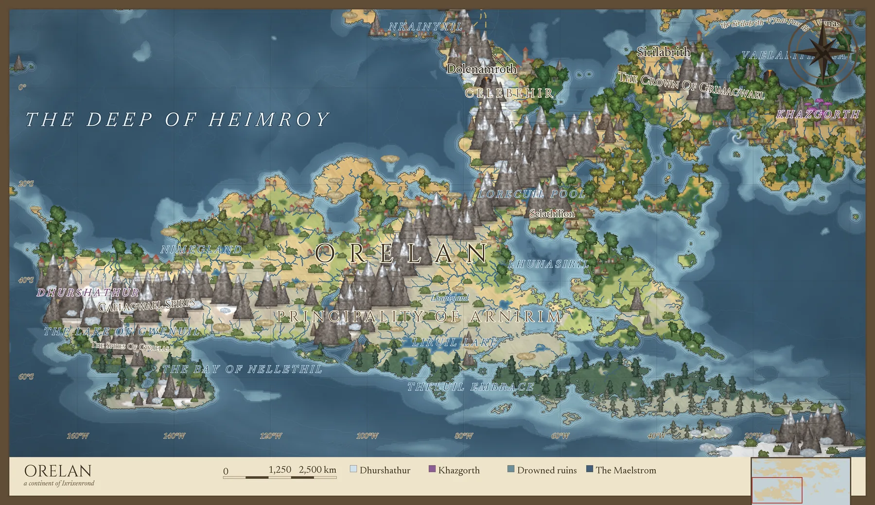
Nine cartographic recipes with editable layer order, colours, line weights and label halos, plus contours, realm fills, compass, scale and vignette. Save a style, or share it as a small file.
05 — The writing workspace
A distance in your book cannot drift from the map.
The manuscript editor lives inside the same vault as the lore. Type [[ and a
name to link any settlement, river or realm. Pin a scene to the map. Ask what the weather
was on the day the caravan left. The checks read your chapters against the world and tell
you when a date, a name or a day's ride no longer agrees with it.
- Names come from tongues — language families you define, so a coast sounds like its people.
- History you can play — the Chronicle turns eras and events into a changing historical map.
- Questions, measured — the Codex asks what the simulation cannot answer: who rules, who is allowed, what proves the right.
- Leaves as a book — Word with real footnotes and tracked changes, Markdown, Scrivener, EPUB, HTML.
06 — What it costs you
The numbers most pages bury.
CartoVox is a desktop instrument. It does real simulation on your own machine, and it tells you what that will take before it starts.
Time
Candidate previews are lightweight — a quick search takes about twenty seconds on a fast machine. A full build with every publication plate currently takes about 8 minutes on a high-end Apple Silicon Mac and about 13 minutes on a high-end Windows machine. The progress panel names the phase and plate and recalibrates its estimate as plates finish.
Disk
Budget 45–100 MiB for a Quick world, 180–360 MiB for a Full world without illustrated plates, and 337–883 MiB with every publication plate. The preflight reports the range and your free space, learns from your own finished builds, and warns before anything large.
Machine
macOS 12+ on Apple Silicon, Windows 10/11 x64, or a modern glibc Linux desktop. 8 GB of memory minimum; a full build peaks around 9 GiB on macOS, so 16 GB is comfortable. A keyboard and a precise pointer — the mobile layout is for reviewing a world, not building one.
Honesty
Every map view is classified: simulated field, deterministic derivative, proxy, heuristic, render-only detail, authored override or reversible scenario. The known limits — climate, erosion, isostasy, soils, society — are documented at length inside the application, before you build a story on a number.
Your worlds are yours
Publish it. Print it. Sell it.
Everything CartoVox generates for you — worlds, maps, atlases, gazetteers, chronicles, codex vaults, names and manuscripts — belongs to you. Use it commercially with no royalty and no attribution. Your work is a file on your disk in an open, documented layout: an Obsidian-compatible vault, GeoJSON, SVG, OBJ and STL terrain, GeoTIFFs, and a scientific archive you can read with NumPy.
No generative AI. Every place, name and event is derived from the simulation and the naming system. The same seed and the same settings give you the same world, every time, on every machine — which is the only kind of world you can defend in a sequel.
The beta
The beta lives on Discord.
CartoVox is in a controlled beta with a small group of invited testers. Builds, release notes, checksums and feedback all happen on the server; each tester receives a personal access key, verified offline on their own computer.
Join the Discord serverInstallers are currently unsigned, so macOS Gatekeeper and Windows SmartScreen will warn you. Every build ships with checksums; install only what the server publishes.
What ships
- macOSApple Silicon disk image (.dmg). Intel Macs are not a supported target.
- Windowsx64 setup installer (.exe) for Windows 10 and 11.
- LinuxDebian/Ubuntu package (.deb), and a portable archive for other glibc 2.28+ x86-64 distributions.
Updates are your decision
CartoVox can check once a day whether a newer version exists and will tell you when one does — installing it is a button you press. It never replaces itself, and the check sends no world or author data. You can turn it off and still ask on demand.
Questions
Before you ask on the server.
Does CartoVox use generative AI?
No. Names come from a language-aware naming system built on families you can define; every event, distance and number is derived from the simulation. It is reproducible: the same seed and settings give the same world on every machine.
Does it need an internet connection or an account?
Neither. CartoVox runs entirely on your computer with no account, no cloud service and no telemetry. The only optional network call is a once-a-day check for a newer version, which you can switch off.
Can I start from a map I already have?
Yes. Import a PNG, JPEG, TIFF or numeric heightfield and CartoVox reads the coastline — pale oceans, dark silhouettes, sepia maps and elevation maps are distinguished — then simulates climate, rivers, biomes and civilisation on it. You can also draw the coasts on a blank, wrapping canvas, or trace a reference image with magnetic outlines.
Can I sell what I make with it?
Yes. Worlds, maps, atlases, names, chronicles and manuscripts generated for you are yours, including for novels, game products, prints and commercial client work, with no royalty and no attribution. The application itself is proprietary and may not be redistributed; the full terms are in the licence.
Is the simulation scientifically accurate?
It is physically motivated and deliberately simplified. Plates, climate, currents, hydrology and soils follow a real causal chain and are checked against Earth-like bands, but CartoVox is a worldbuilding model, not a forecasting package. It documents its known limits at length inside the app.
How big is a world on disk, and how long does it take?
A Quick world is 45–100 MiB; a Full world with every publication plate can reach 883 MiB and takes about 8 minutes on a high-end Mac or 13 on a high-end Windows machine. The preflight tells you the exact estimate for your settings before anything starts, and you can build the plates later from saved data.
Where is the manual?
Inside the application, offline — every feature in the order the simulation produces it, the known limits, the licence and the third-party notices. The Help rail is one click from any workspace. The same material is on this site as the field guide, and every version's changes are in the release notes.
How do I get in?
Join the Discord server. Invitations, builds, checksums and feedback all happen there; a personal access key unlocks the app once, offline.